Hersin-Coupigny
| Hersin-Coupigny | ||
|---|---|---|

|
|
|
| region | Hauts-de-France | |
| Department | Pas-de-Calais | |
| Arrondissement | Bethune | |
| Canton | Nœux-les-Mines | |
| Community association | Béthune-Bruay, Artois-Lys novels | |
| Coordinates | 50 ° 27 ' N , 2 ° 39' E | |
| height | 46-186 m | |
| surface | 12.02 km 2 | |
| Residents | 6,245 (January 1, 2017) | |
| Population density | 520 inhabitants / km 2 | |
| Post Code | 62530 | |
| INSEE code | 62443 | |
| Website | http://www.ville-hersin-coupigny.fr/ | |
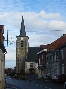
 Hersin-Coupigny town hall |
||
Hersin-Coupigny is a French municipality with 6245 inhabitants (as of January 1 2017) in the department of Pas-de-Calais in the region of Hauts-de-France . The municipality in the arrondissement of Béthune belongs to the municipal association of Béthune-Bruay, Artois-Lys Romane and the canton of Nœux-les-Mines .
geography
Hersin-Coupigny is a former mining town and is located in the Gohelle countryside . Neighboring municipalities are Nœux-les-Mines in the north, Sains-en-Gohelle in the east, Bouvigny-Boyeffles in the southeast, Servins in the south, Fresnicourt-le-Dolmen in the southwest and Barlin in the west.
history
In 1537 the place was destroyed by a fire.
Population development
| Population development | ||||||||
|---|---|---|---|---|---|---|---|---|
| year | 1962 | 1968 | 1975 | 1982 | 1990 | 1999 | 2006 | 2011 |
| Residents | 8,688 | 7,980 | 7,500 | 7,015 | 6,679 | 6,498 | 6.265 | 6.161 |
Attractions
- Saint-Martin church, rebuilt in 1772 with parts of the earlier church from the 16th century
- 18th century Château de Coupigny, restored around 1900
- Ruins of the old windmill
- Commonwealth War Graves Commission cemetery
Web links
Commons : Hersin-Coupigny - Collection of images, videos and audio files

