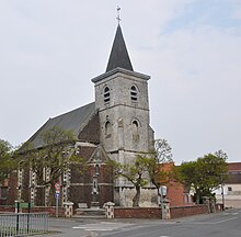
Gosnay
| Gosnay | ||
|---|---|---|

|
|
|
| region | Hauts-de-France | |
| Department | Pas-de-Calais | |
| Arrondissement | Bethune | |
| Canton | Nœux-les-Mines | |
| Community association | Béthune-Bruay, Artois-Lys novels | |
| Coordinates | 50 ° 30 ′ N , 2 ° 35 ′ E | |
| height | 25-61 m | |
| surface | 2.21 km 2 | |
| Residents | 951 (January 1, 2017) | |
| Population density | 430 inhabitants / km 2 | |
| Post Code | 62199 | |
| INSEE code | 62377 | |
Gosnay is a French municipality with 951 inhabitants (as of January 1 2017) in the department of Pas-de-Calais in the region of Hauts-de-France . It belongs to the Arrondissement of Béthune and the canton of Nœux-les-Mines (until 2015: Canton Barlin ) and is a member of the Béthune-Bruay, Artois-Lys Romane community association .
geography
Gosnay is about four kilometers west-southwest of Béthune . The rivers Brette and Blanche , tributaries of the Lawe , flow through the municipality. Gosnay is surrounded by the neighboring communities of Chocques in the north, Annezin in the northeast, Fouquereuil in the east, Gosnay in the south and southeast, Bruay-la-Buissière in the south and southwest and Lapugnoy in the west.
The A26 autoroute runs on the northeastern edge of the municipality.
Population development
| 1962 | 1968 | 1975 | 1982 | 1990 | 1999 | 2006 | 2012 | |
|---|---|---|---|---|---|---|---|---|
| 1,509 | 1,388 | 1,297 | 1,178 | 1,226 | 1,195 | 1,092 | 990 | |
| Source: Cassini and INSEE | ||||||||
Attractions
- Saint-Léger church from the 17th century
- Old Carthusian monastery, women's and men's convent since 1986 Monument historique
- British military cemetery


