Saint-Lormel
|
Saint-Lormel Sant-Loheñvel |
||
|---|---|---|
|
|
||
| region | Brittany | |
| Department | Cotes-d'Armor | |
| Arrondissement | Dinan | |
| Canton | Plancoët | |
| Community association | Dinan agglomeration | |
| Coordinates | 48 ° 33 ′ N , 2 ° 14 ′ W | |
| height | 0-61 m | |
| surface | 9.77 km 2 | |
| Residents | 860 (January 1, 2017) | |
| Population density | 88 inhabitants / km 2 | |
| Post Code | 22130 | |
| INSEE code | 22311 | |
| Website | http://www.saint-lormel.fr/ | |
Saint-Lormel ( Breton : Sant-Loheñvel ) is a municipality with 860 inhabitants (as of January 1, 2017) in the Côtes-d'Armor department of the Brittany region in north-western France . Saint-Lormel belongs to the arrondissement of Dinan and the canton of Plancoët .
geography
Saint-Lormel is about 20 kilometers northwest of Dinan . The Arguenon limits the community in the east. Saint-Lormel is surrounded by the neighboring communities of Saint-Cast-le-Guildo in the north, Créhen in the east, Plancoët in the south and south-east, Pluduno in the west and south-west and Saint-Pôtan in the west.
Population development
| year | 1793 | 1846 | 1896 | 1911 | 1946 | 1962 | 1968 | 1975 | 1982 | 1990 | 1999 | 2006 | 2012 |
| Residents | 352 | 387 | 901 | 816 | 681 | 729 | 716 | 736 | 780 | 787 | 777 | 876 | 895 |
Attractions
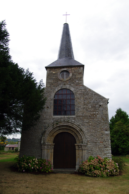
- Old Saint-Lunaire church from the 12th century, minor alterations from the 15th century, Monument historique
- Le Ville-Robert castle from the 17th / 18th centuries century
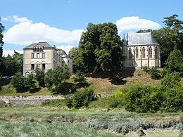
- L'Argentaye castle with chapel, originally built in the 11th century, monument historique since 1993
literature
- Le Patrimoine des Communes des Côtes-d'Armor. Flohic Editions, Volume 2, Paris 1998, ISBN 2-84234-017-5 , pp. 870-873.
Web links
Commons : Saint-Lormel - Collection of images, videos and audio files


