Savigny (Haute-Savoie)
| Savigny | ||
|---|---|---|

|
|
|
| region | Auvergne-Rhône-Alpes | |
| Department | Haute-Savoie | |
| Arrondissement | Saint-Julien-en-Genevois | |
| Canton | Saint-Julien-en-Genevois | |
| Community association | Genevois | |
| Coordinates | 46 ° 5 ' N , 5 ° 57' E | |
| height | 489-1,112 m | |
| surface | 10.52 km 2 | |
| Residents | 893 (January 1, 2017) | |
| Population density | 85 inhabitants / km 2 | |
| Post Code | 74520 | |
| INSEE code | 74260 | |
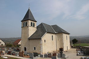
 Savigny village church |
||
Savigny is a French commune in the department of Haute-Savoie in the region of Auvergne Rhône-Alpes .
geography
Savigny is located at 568 m , about 22 kilometers northwest of the city of Annecy (as the crow flies). The scattered settlement community extends at the eastern foot of the Montagne de Vuache , slightly elevated above the broad basin of the Fornant, in the Genevois .
The area of the 10.52 km² municipal area includes a section of the Genevois. The eastern part of the area lies in the valley of the Fornant (right bank of the Usses). From here the community area extends over the terraced area of Savigny with arable and meadow land to the densely wooded, narrow ridge of the Montagne de Vuache, on which the highest elevation of Savigny is reached at 1101 m . The northern boundary is the wide ridge of the Montagne de Sion.
In addition to the actual town center, Savigny also includes various hamlet settlements and farms, including:
- Nyoux ( 510 m ) in the Fornant valley basin
- Murcier ( 596 m ) in the transition area between Montagne de Vuache and Montagne de Sion
- Cortagy ( 630 m ) on the eastern slope of the Montagne de Vuache
- Olliet ( 680 m ) on the eastern slope of the Montagne de Vuache
- Cessens ( 730 m ) on the eastern slope of the Montagne de Vuache
Neighboring communities of Savigny are Dingy-en-Vuache in the north, Jonzier-Épagny in the east, Minzier in the southeast and Chaumont in the west.
history
The municipality of Savigny was already settled in the Neolithic and Roman times. The place was first mentioned in a document in the early 15th century. The place name goes back to the Gallo-Roman personal name Sabinus and means estate of Sabinus .
Attractions
The village church of Savigny was built in the 19th century and has a dome in the Sardinian style.
Population development
| year | Residents |
|---|---|
| 1962 | 343 |
| 1968 | 322 |
| 1975 | 307 |
| 1982 | 338 |
| 1990 | 458 |
| 1999 | 500 |
| 2004 | 633 |
With 893 inhabitants (as of January 1, 2017), Savigny is one of the small communities in the Haute-Savoie department. In the course of the 19th and 20th centuries, the population decreased continuously due to strong emigration (in 1861 there were 595 inhabitants in Savigny). Since the beginning of the 1980s, however, there has been a significant increase in population.
Economy and Infrastructure
Savigny is still today a predominantly agricultural village. There are also some local small businesses. A large number of workers are commuters who work in the larger towns in the area as well as in the Annecy and Geneva-Annemasse area.
The village is located off the major thoroughfares on a departmental road that leads from Vulbens to Chaumont. Further road connections exist with Jonzier-Épagny and Minzier.

