Le Sappey
| Le Sappey | ||
|---|---|---|

|
|
|
| region | Auvergne-Rhône-Alpes | |
| Department | Haute-Savoie | |
| Arrondissement | Saint-Julien-en-Genevois | |
| Canton | La Roche-sur-Foron | |
| Community association | Pays de Cruseilles | |
| Coordinates | 46 ° 5 ' N , 6 ° 10' E | |
| height | 710-1,340 m | |
| surface | 13.72 km 2 | |
| Residents | 409 (January 1, 2017) | |
| Population density | 30 inhabitants / km 2 | |
| Post Code | 74800 | |
| INSEE code | 74259 | |
Le Sappey is a French commune in the department of Haute-Savoie in the region of Auvergne Rhône-Alpes .
geography
Le Sappey is located at 901 m , about 20 kilometers north of the city of Annecy (as the crow flies). The scattered settlement community stretches out in a panoramic position on the southeast slope of the Salève , above the Usses valley on the edge of the Bornes plateau.
The area of the 13.72 km² municipal area includes a section in the area of Mont Salève. The eastern border runs along the Usses , a left tributary of the Rhone . This body of water flows in a wide valley to the southwest, parallel to the ridge of the Salève. From the valley low, the communal soil extends westward over the relatively gently sloping slope of Le Sappey, which is followed by the densely wooded steep slope of the Salève. The north-western border lies on the wide ridge of the Salève. Near the top of the Grand Piton , Le Sappey's highest point is reached at 1340 m . In the extreme northeast the community area extends over a saddle to the Viaison , a left tributary of the Arve .
In addition to the actual village, Le Sappey also includes the hamlet settlements of Cornillon ( 740 m ) in the Usses Valley, Clarnant ( 850 m ) on the eastern slope of the Salève and Chez Fauraz ( 824 m ) in the headwaters of the Viaison. Neighboring municipalities of Le Sappey are Archamps and La Muraz in the north, Arbusigny and Menthonnex-en-Bornes in the east, Vovray-en-Bornes in the south and Présilly and Beaumont in the west.
history
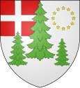
Le Sappey is first mentioned in writing in the 15th century. The place name goes back to the late Latin word sapinus (fir).
Attractions
The village church in neo-Romanesque style dates from the 19th century in its current form. There is an old mill on the Usses.
population
| Population development | |
|---|---|
| year | Residents |
| 1962 | 238 |
| 1968 | 218 |
| 1975 | 190 |
| 1982 | 172 |
| 1990 | 284 |
| 1999 | 333 |
| 2005 | 378 |
With 409 inhabitants (as of January 1, 2017), Le Sappey is one of the small communities in the Haute-Savoie department. In the first half of the 20th century the population decreased continuously (1901 Le Sappey still had 506 inhabitants). Since the beginning of the 1980s, however, there has been a significant increase in population.
Economy and Infrastructure
Le Sappey is still today a predominantly agricultural village. There are also some local small businesses. Some workers are commuters who work in the larger towns in the area, but especially in the Geneva-Annemasse and Annecy area .
The village is located off the main thoroughfares a little above a local road that leads from Monnetier-Mornex along the southeastern foot of the Salève to Cruseilles . Further road connections exist with Arbusigny and Menthonnex-en-Bornes. The closest connection to the A41 motorway is around 15 km away.
