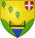
Éloise
| Éloise | ||
|---|---|---|

|
|
|
| region | Auvergne-Rhône-Alpes | |
| Department | Haute-Savoie | |
| Arrondissement | Saint-Julien-en-Genevois | |
| Canton | Saint-Julien-en-Genevois | |
| Community association | Usses and Rhône | |
| Coordinates | 46 ° 5 ' N , 5 ° 51' E | |
| height | 330-533 m | |
| surface | 8.95 km 2 | |
| Residents | 864 (January 1, 2017) | |
| Population density | 97 inhabitants / km 2 | |
| Post Code | 74910 | |
| INSEE code | 74109 | |
| Website | www.eloise.fr | |
Éloise is a French commune in the department of Haute-Savoie in the region of Auvergne Rhône-Alpes .
geography
Éloise is located at 510 m , near Bellegarde-sur-Valserine , about 28 kilometers northwest of the city of Annecy (as the crow flies). The farming village extends from a panoramic location on the high plateau west of the Montagne de Vuache , between the deeply cut valleys of the Rhone and Usses , in the Genevois .
The area of the 8.95 km² municipality covers a section of the western Genevois. The northern border is formed by the Rhône, which lies from east to west in a valley sunk more than 150 m deep into the surrounding plateaus and is dammed up by the Génissiat dam. At Bellegarde-sur-Valserine it draws a sharp bend and flows south. The community area extends from the course of the river to the high plateau adjacent to the south ( 500 m on average ), which is subdivided by several short erosion valleys. At the edge of the Bois du Clos forest area, the highest elevation of Éloise is reached at 533 m .
In addition to the actual town center, Éloise also includes several hamlet settlements and farmsteads, including:
- Bois d'Arlod ( 430 m ) on the western slope of the plateau above Bellegarde
- Fiolaz ( 490 m ) on the high plateau of Éloise
Neighboring municipalities of Éloise are Bellegarde-sur-Valserine and Léaz in the north, Clarafond-Arcine in the east, Chêne-en-Semine in the south and Saint-Germain-sur-Rhône in the west.
history
The municipality of Éloise was already settled in the Neolithic . The village was first mentioned in the 12th century under the name Ehelusia . The Saint-Oyen de Joux monastery owned rich estates in the area. Éloise was assigned to the newly created Canton of Frangy in 1860 ; before it belonged to the canton of Seyssel .
Attractions
The village church of Éloise dates from the 18th century. The Pont de Grésin , a suspension bridge below the village that can only be reached via a dirt road , the forerunner of which was part of the Spanish Road in the 17th century , which enabled the Spanish Habsburgs to connect with the Spanish Netherlands .
population
| Population development | |
|---|---|
| year | Residents |
| 1962 | 292 |
| 1968 | 377 |
| 1975 | 444 |
| 1982 | 487 |
| 1990 | 656 |
| 1999 | 715 |
| 2004 | 872 |
With 864 inhabitants (as of January 1, 2017), Éloise is one of the small communities in the Haute-Savoie department. Since the mid-1960s, thanks to its proximity to Bellegarde-sur-Valserine, there has been a significant increase in population.
Economy and Infrastructure
Éloise is still a predominantly agricultural village today . There are also some local small businesses. A large number of those in employment are commuters who work in the larger towns in the area, particularly in Bellegarde-sur-Valserine .
The place is well developed in terms of traffic. It is close to the main road N508 which runs from Annecy to Bellegarde-sur-Valserine. Another road connection is with Saint-Germain-sur-Rhône. The next connection to the A40 motorway , which crosses the municipality, is around 2 km away.
