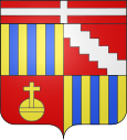
Feigères (Haute-Savoie)
| Feigères | ||
|---|---|---|

|
|
|
| region | Auvergne-Rhône-Alpes | |
| Department | Haute-Savoie | |
| Arrondissement | Saint-Julien-en-Genevois | |
| Canton | Saint-Julien-en-Genevois | |
| Community association | Genevois | |
| Coordinates | 46 ° 7 ' N , 6 ° 5' E | |
| height | 453-680 m | |
| surface | 7.66 km 2 | |
| Residents | 1,682 (January 1, 2017) | |
| Population density | 220 inhabitants / km 2 | |
| Post Code | 74160 | |
| INSEE code | 74124 | |
| Website | www.feigeres.fr | |
 The village of Feigères seen from the north with Mont Sion and Salève (left) in the background |
||
Feigères is a French commune in the department of Haute-Savoie in the region of Auvergne Rhône-Alpes .
geography
Feigères is located at 560 m , about ten kilometers south-southwest of the city of Geneva (as the crow flies). The village extends slightly higher on the southern edge of the Geneva basin, in the Genevois , at the northern foot of Mont Sion and northwest of the Salève , near the border with Switzerland .
The area of the 7.66 km² municipal area includes a section of the Genevois. The municipal area is bordered by the valley of the Nant de Feigères to the east and that of the Nant d'Ogny to the west . Both streams unite at the northernmost point and are drained through the Aire to the Arve . The Feigères plateau stretches between the respective valley lowlands, sloping slightly to the north (2% on average). To the south, the community soil extends to the foot of Mont Sion and the headwaters of the Laire . Here, at 680 m, the highest elevation of Feigères is reached.
In addition to the original village, Feigères also includes the hamlets of Grossaz ( 525 m ) on the Nant d'Ogny as well as Malchamp ( 586 m ) and Lagnellu ( 610 m ) at the northern foot of Mont Sion. Neighboring municipalities of Feigères are Saint-Julien-en-Genevois in the north, Neydens and Beaumont in the east, Présilly in the south and Viry in the west.
history
The municipality of Feigères was already settled in Roman times. The place name developed in the Middle Ages from Felgeriac and Felgeriacum via Faygères to Feygères . It goes back to the Latin word filix (bracken). Feigères belonged to the Counts of Geneva until 1401; then it came to Savoy and shared its fate. A change of area took place in 1924 when the hamlet of Cervonnex was split off from Feigères and assigned to Saint-Julien-en-Genevois.
Attractions
The village church of Feigères was built in the 19th century. Some characteristic farmhouses have been preserved in the old town center.
Population development
| year | Residents |
|---|---|
| 1962 | 398 |
| 1968 | 471 |
| 1975 | 638 |
| 1982 | 855 |
| 1990 | 962 |
| 1999 | 1,232 |
| 2006 | 1,358 |
With 1682 inhabitants (as of January 1, 2017) Feigères is one of the smaller communities in the Haute-Savoie department. The population has continued to grow rapidly since the 1960s. Numerous single-family houses were built outside the old town center.
Economy and Infrastructure
Until well into the 20th century, Feigères was a predominantly agricultural village. Today there are various small and medium-sized businesses. A large number of employed people are also commuters who go to work in the larger towns in the area, especially in the Geneva-Annemasse area.
The place is well developed in terms of traffic. It lies on a connecting road that leads from Saint-Julien-en-Genevois to Andilly on Mont Sion. Further road connections exist with Viry and Beaumont. On the edge of the municipality, the A40 motorway runs to the north and the A41 to the east . The next joint connection to the two motorways is around 4 km away.

