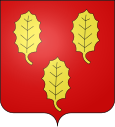
Archamps
| Archamps | ||
|---|---|---|

|
|
|
| region | Auvergne-Rhône-Alpes | |
| Department | Haute-Savoie | |
| Arrondissement | Saint-Julien-en-Genevois | |
| Canton | Saint-Julien-en-Genevois | |
| Community association | Genevois | |
| Coordinates | 46 ° 8 ' N , 6 ° 8' E | |
| height | 482-1,350 m | |
| surface | 10.69 km 2 | |
| Residents | 2,556 (January 1, 2017) | |
| Population density | 239 inhabitants / km 2 | |
| Post Code | 74160 | |
| INSEE code | 74016 | |
| Website | www.mairie-archamps.fr | |
Archamps is a French commune in the department of Haute-Savoie in the region of Auvergne Rhône-Alpes .
geography
Archamps is located at 531 m above sea level, about eight kilometers south of the city of Geneva (as the crow flies). The village extends on a terrace at the northwestern foot of the Salève , on the Drize , on the edge of the Genevois , in the immediate vicinity of the border with Switzerland .
The area of the 10.69 square kilometers large municipal area includes a section of the Genevois. The northern border runs on the edge of the plain of the Geneva Basin in a depression that connects the valley lowlands of the Drize in the east and the Arande in the west. From here the community area extends south to the plateau-like terrace of Archamps. Further south, the slope climbs gently at first, then very steeply to the Grand Salève. On the wide ridge of the Salève, the highest point of Archamps is reached at 1354 m.
In addition to the original village, Archamps also includes the settlements Blécheins ( 621 m ) and Chotard ( 625 m ) on the lower northwest slope of the Salève. Neighboring communities of Archamps are Collonges-sous-Salève and La Muraz in the east, Le Sappey and Beaumont in the south, Neydens and Saint-Julien-en-Genevois in the west and the Swiss community Bardonnex in the north.
history
Archamps only became an independent municipality in 1836. Before that it belonged to Collonges-sous-Salève.
Attractions
The village church received its present form in 1848 when it was rebuilt in the neoclassical style. Next to the church is the rectory from the 18th century.
population
| year | Residents |
|---|---|
| 1962 | 613 |
| 1968 | 724 |
| 1975 | 874 |
| 1982 | 1.005 |
| 1990 | 1,070 |
| 1999 | 1,235 |
| 2006 | 1,636 |
With 2556 inhabitants (as of January 1, 2017) Archamps is one of the smaller communities in the Haute-Savoie department. The population has continued to grow rapidly since the 1960s. Numerous single-family houses were built outside the old town center.
Economy and Infrastructure
Archamps was a predominantly agricultural village well into the 20th century . Today there are various small and medium-sized businesses. On the plateau west of the village, the Site d'Archamps , a technology park with more than 150 companies in the fields of IT, telecommunications and electronics , has emerged over the last few decades . A large number of employed people are also commuters who go to work in the larger towns in the area, especially in the Geneva-Annemasse area.
The village is very well developed in terms of traffic. It lies above the main road N206 , which runs from Annemasse along the Swiss border to Saint-Julien-en-Genevois . The A40 motorway also crosses the municipal area, the next connection is around a kilometer away. Archamps owned a station on the Annemasse – Bellegarde railway line .

