Tours-sur-Meymont
| Tours-sur-Meymont | ||
|---|---|---|

|
|
|
| region | Auvergne-Rhône-Alpes | |
| Department | Puy-de-Dôme | |
| Arrondissement | Ambert | |
| Canton | Les Monts du Livradois | |
| Community association | Ambert Livradois Forez | |
| Coordinates | 45 ° 40 ′ N , 3 ° 35 ′ E | |
| height | 360-823 m | |
| surface | 18.09 km 2 | |
| Residents | 516 (January 1, 2017) | |
| Population density | 29 inhabitants / km 2 | |
| Post Code | 63590 | |
| INSEE code | 63434 | |
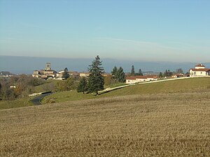
 View of Tours-sur-Meymont |
||
Tours-sur-Meymont is a French municipality with 516 inhabitants (as of January 1 2017) in the department of Puy-de-Dôme in the region Auvergne Rhône-Alpes (before 2016 Auvergne ). Tours-sur-Meymont is part of the Arrondissement of Ambert and the canton of Les Monts du Livradois ( Saint-Dier-d'Auvergne until 2015 ).
location
Tours-sur-Meymont is located about 39 kilometers east-southeast of Clermont-Ferrand in Limagne . Tours-sur-Meymont is surrounded by the neighboring municipalities of Sauviat in the north, Augerolles in the northeast, Olliergues in the east and northeast, Saint-Gervais-sous-Meymont in the east, La Chapelle-Agnon in the southeast, Cunlhat in the south and Domaize in the west.
Population development
| year | 1962 | 1968 | 1975 | 1982 | 1990 | 1999 | 2006 | 2013 |
| Residents | 747 | 752 | 635 | 569 | 511 | 522 | 508 | 530 |
| Source: Cassini and INSEE | ||||||||
Attractions
- Church from the 14th century, alterations from the 16th century, monument historique since 1991
- Bourgnon Castle, built from 1772 to 1792, monument historique since 1996
Web links
Commons : Tours-sur-Meymont - Collection of images, videos and audio files
