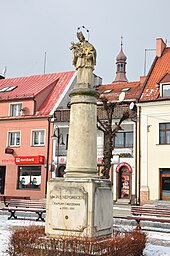
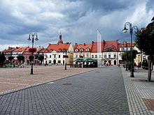
Żory
| Żory | ||
|---|---|---|

|
|
|
| Basic data | ||
| State : | Poland | |
| Voivodeship : | Silesia | |
| Powiat : | District-free city | |
| Area : | 65.00 km² | |
| Geographic location : | 50 ° 3 ' N , 18 ° 42' E | |
| Residents : | 62,462 (Jun. 30, 2019) |
|
| Postal code : | 44-240 | |
| Telephone code : | (+48) 32 | |
| License plate : | SZO | |
| Economy and Transport | ||
| Street : | Skoczow - Katowice | |
| Rybnik - Pszczyna | ||
| Next international airport : | Katowice | |
| Gmina | ||
| Gminatype: | Borough | |
| Surface: | 65.00 km² | |
| Residents: | 62,462 (Jun. 30, 2019) |
|
| Population density : | 961 inhabitants / km² | |
| Community number ( GUS ): | 2479011 | |
| Administration (as of 2007) | ||
| Mayor : | Waldemar Socha | |
| Address: | Aleja Wojska Polskiego 25 44-240 Żory |
|
| Website : | www.zory.pl | |
Żory [ ˈʐɔrɨ ] ( German: Sohrau ) is a city with around 60,000 inhabitants in the southwestern part of the Polish Silesian Voivodeship .
geography

location
The city is located in the Upper Silesia region on the Raude (Polish Ruda) at 283 m above sea level. NHN , about 30 kilometers southwest of Katowice in southeast Silesia. The Czech border is about 20 kilometers southwest of the city.
City structure and population
Żory is divided into the following districts:
| district | Residents |
|---|---|
| os. 700-lecia Żor [settlement "700 years Żory"] |
3397 |
| os. Sikorskiego [Władysław Sikorski settlement] |
9972 |
| os. Korfantego [Korfanty settlement] |
4879 |
| os. Księcia Władysława [Duke Władysław Settlement] |
7363 |
| os. Pawlikowskiego [Pawlikowski settlement] |
6477 |
| os. Powstańców Śląskich [Settlement of the Silesian Insurgents] |
5851 |
| Zachód [West] | 3543 |
| Śródmieście [inner city] | 2612 |
| Kleszczówka (Klischczowka) | 3546 |
| Rowień - Folwarki (Rowin) | 2355 |
| Osiny (Oschin) | 1155 |
| Kleszczów (Klischczow) | 1692 |
| Baranowice (Baranowitz) | 1669 |
| Rogoźna (Rogoisna) | 2001 |
| Rój (Roy) | 4262 |
history
Sohrau received city rights after 1273 and had been a village up to that point. Until 1532 the city belonged to the Duchy of Opole - Ratibor . The city suffered severe setbacks repeatedly, from the plague in 1558 and from city fires in 1552, 1583, 1661, 1702 and 1807. In 1807 the town hall on the ring was destroyed and not rebuilt afterwards.
Around 1783 the city was surrounded by a wall, but the alleys were not yet paved, but covered with uncut wood. In 1782, Frederick II provided the town with construction aid amounting to 12,850 Reichstalers for the construction of six new buildings and for the settlement of ten cloth makers and other skilled workers. In the 18th and 19th centuries, linen weaving was of great importance to the city. The iron and machine industry took its place in the 19th century.
In 1818 the city became part of the newly formed Prussian district of Rybnik .
At the beginning of the 20th century Sohrau had a Protestant and a Catholic church, a synagogue , an iron foundry and machine factory, a wool weaving mill, two sawmills, a grain mill, two brick factories, an electricity company and was the seat of a local court .
In the referendum in Upper Silesia on March 20, 1921, 2,353 votes (69.4%) were cast in Sohrau to remain with Germany, while 1,036 votes (30.6%) were in favor of joining Poland. With most of the Rybnik district, the city was incorporated into the Polish state on July 3, 1922.
When the Wehrmacht invaded Poland on October 26, 1939, the city was captured and the synagogue was destroyed . On March 24, 1945, the war-torn city was captured by the Red Army . Most of the German population was expelled in the following years. Due to the closings of collieries and smelters, there is high unemployment today.
Demographics
| year | population | Remarks |
|---|---|---|
| 1783 | 1100 | of which 979 Christians and 121 Jews (214 town houses and 88 desolate places) |
| 1794 | 1554 | Polish language is predominant |
| 1803 | 1683 | |
| 1807 | 1711 | |
| 1810 | 1788 | |
| 1816 | 1982 | according to other data 1982 inhabitants, 84 of them Evangelicals, 1696 Catholics, 202 Jews |
| 1818 | 2041 | |
| 1820 | 2116 | |
| 1821 | 2185 | |
| 1825 | 2234 | including 127 Evangelicals and 274 Jews |
| 1831 | 2701 | |
| 1837 | 3355 | |
| 1840 | 3848 | 98 Evangelicals, 3258 Catholics, 492 Jews |
| 1843 | 4044 | |
| 1849 | 3438 | after the famine and typhoid epidemic of 1846–1849 |
| 1855 | 3346 | according to other data 3336 inhabitants |
| 1858 | 3611 | |
| 1861 | 3662 | of which 211 Protestants, 2976 Catholics, 475 Jews; 1264 inhabitants speak German, 2398 Polish |
| 1867 | 3991 | on December 3rd |
| 1871 | 4042 | including 250 Protestants and 500 Jews (2100 Poles ); According to other data, 4043 inhabitants (on December 1), of which 175 are Protestants, 3493 Catholics, 375 Jews |
| 1890 | 4429 | 235 Evangelicals, 3944 Catholics, 250 Jews |
| 1905 | 4642 | including 323 Protestants and 98 Jews |
| 1910 | 4936 |
- Number of inhabitants to date

Colleges
- Górnośląska Wyższa Szkoła Handlowa im. Wojciecha Korfantego in Katowice - Żory place of study
- Politechnika Śląska in Gliwice - place of study Żory
Town twinning
Żory has partnerships with the following cities:
Personalities
sons and daughters of the town
- Reinhold von Krockow (1767–1821), Prussian officer and free corps leader
- Daniel Fränkel (1821–1890), Jewish theologian and rabbi
- Johannes Simon Nikel (1863-1924), Catholic German theologian
- Otto Stern (1888–1969), physicist, Nobel Prize winner
- Albert Wilhelm Kukowka (1894–1977), doctor, balneologist and author
- Gustav Kucz (1901–1963), archivist, interpreter and hymn translator
- Jerzy Makula (* 1952), Polish glider aerobatics
- Stanisław Sojka (* 1959), Polish jazz singer and composer
- Iwona Węgrowska (* 1982), Polish singer
- Ewa Swoboda (* 1997), Polish athlete
People connected to this place
- Piotr Klimek (1881–1940), provost and dean in Żory from 1924 to 1940 . A street in Żory has been named after him.
traffic
The A1 motorway runs west of the city center .
See also
literature
- Felix Triest : Topographical Handbook of Upper Silesia , Wilh. Gottl. Korn, Breslau 1865, pp. 791-796 .
- Sohrau (Żory, Kr.Rybnik) . In: Hugo Weczerka (Hrsg.): Handbook of historical places . Volume: Silesia (= Kröner's pocket edition . Volume 316). Kröner, Stuttgart 1977, ISBN 3-520-31601-3 , pp. 510-512.
- Augustin Weltzel : History of the city of Sohrau in Upper Silesia , 1888. → Polish translation: Historia miasta Żory na Górnym Śląsku , 1997.
- The life of Elena Silber - Alexander Osang
Web links
- Official website of the city (English and Polish)
- City administration information page (Polish)
Individual evidence
- ↑ a b population. Size and Structure by Territorial Division. As of June 30, 2019. Główny Urząd Statystyczny (GUS) (PDF files; 0.99 MiB), accessed December 24, 2019 .
- ↑ a b c Meyer's Large Conversation Lexicon . 6th edition, Volume 18, Leipzig / Vienna 1909, p. 570 .
- ↑ B. Kieczka, G. Utrata - Moja "Mała Ojczyzna" Dzieje Zor wydanie XI
- ↑ a b c d Friedrich Gottlob Leonhardi : Earth Description of the Prussian Monarchy , Volume 3, Part 1, Halle 1792, pp. 109-110 .
- ↑ See results of the referendum ( Memento of March 4, 2016 in the Internet Archive ). on August 24, 2010
- ↑ a b c d e f g h i j k Felix Triest : Topographisches Handbuch von Oberschlesien , Wilh. Gottl. Korn, Breslau 1865, pp. 792-793 .
- ↑ a b c d Alexander August Mützell and Leopold Krug : New topographical-statistical-geographical dictionary of the Prussian state . Volume 5: T – Z , Halle 1823, pp. 384-391, item 691.
- ↑ Alexander August Mützell and Leopold Krug : New topographical-statistical-geographical dictionary of the Prussian state . Volume 4: P – S , Halle 1823, p. 339, item 309 .
- ↑ Johann Georg Knie : Alphabetical-statistical-topographical overview of the villages, spots, cities and other places of the royal family. Prussia. Province of Silesia, including the Margraviate of Upper Lusatia, which now belongs entirely to the province, and the County of Glatz; together with the attached evidence of the division of the country into the various branches of civil administration. Melcher, Breslau 1830, pp. 1022-1023 .
- ^ Johann Georg Knie : Alphabetical-statistical-topographical overview of the villages, spots, cities and other places of the royal family. Preusz. Province of Silesia. 2nd Edition. Graß, Barth and Comp., Breslau 1845, p. 929 .
- ↑ a b Felix Triest : Topographisches Handbuch von Oberschlesien , Wilh. Gottl. Korn, Breslau 1865, p. 738, paragraph 95 .
- ^ A b Royal Statistical Bureau: The municipalities and manor districts of the province of Silesia and their population. Based on the original materials of the general census of December 1, 1871. Berlin 1874, pp. 350–351, item 3 .
- ^ Gustav Neumann : The German Empire in geographical, statistical and topographical relation . Volume 2, GFO Müller, Berlin 1874, pp. 180-181, item 12 .
- ↑ a b M. Rademacher: German administrative history from the unification of the empire in 1871 to the reunification in 1990. (Online material for the dissertation, Osnabrück 2006)


