Itaguara
From Wikipedia, the free encyclopedia
This is the current revision of this page, as edited by 160.238.228.99 (talk) at 00:11, 19 February 2023 (→Toponym). The present address (URL) is a permanent link to this version.
(diff) ← Previous revision | Latest revision (diff) | Newer revision → (diff)
Town and municipality in the state of Minas Gerais, Brazil

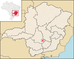
Itaguara is a Brazilian municipality in the state of Minas Gerais. Its population in 2020 was 13,435.[1]
Toponym[edit]
Itaguara is a coinage from Tupi–Guarani, meaning "wolf rock", by combining itá (rock) and guará (Wolf).
See also[edit]
References[edit]
20°23′31″S 44°29′16″W / 20.39194°S 44.48778°W / -20.39194; -44.48778
This geographical article relating to Minas Gerais is a stub. You can help Wikipedia by expanding it. |
Retrieved from "https://en.wikipedia.org/w/index.php?title=Itaguara&oldid=1140207045"

