Itaguara
Tools
Actions
General
Print/export
In other projects
From Wikipedia, the free encyclopedia
The printable version is no longer supported and may have rendering errors. Please update your browser bookmarks and please use the default browser print function instead.
Town and municipality in the state of Minas Gerais, Brazil

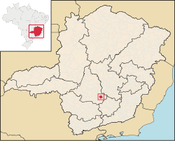
Itaguara is a Brazilian municipality in the state of Minas Gerais. Its population in 2020 was 13,435.[1]
Toponym
Itaguara is a coinage from Tupi–Guarani, meaning "wolf rock", by combining itá (rock) and guará (Wolf).
See also
References
20°23′31″S 44°29′16″W / 20.39194°S 44.48778°W / -20.39194; -44.48778
This geographical article relating to Minas Gerais is a stub. You can help Wikipedia by expanding it. |
Retrieved from "https://en.wikipedia.org/w/index.php?title=Itaguara&oldid=1140207045"

