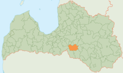
Jaunjelgava district
| Jaunjelgava district | ||
|---|---|---|
 |
||
| Symbols | ||
|
||
| Basic data | ||
| Country | Latvia | |
| Capital | Jaunjelgava | |
| surface | 685 km² | |
| Residents | 6486 (2010) | |
| density | 9.5 inhabitants per km² | |
| ISO 3166-2 | LV-038 | |
| Website | www.jaunjelgava.lv (Latvian) | |
| Landscape near Staburags | ||
Coordinates: 56 ° 37 ' N , 25 ° 5' E
The Jaunjelgava District (Jaunjelgavas novads) is located in central southern Latvia in the Sēlija region .
geography
The sparsely populated wooded area lies south of the Daugava . At Sērene, a road on the dam of the Pļaviņas hydroelectric plant leads to the north bank. The Staburags A rock on the Dünaufer, which was a national symbol, was inundated by the reservoir of the same plant.
population
The district consists of five municipalities (pagasts) Daudzese, Sece, Sērene, Staburags, Sunākste and the administrative center Jaunjelgava . 6486 inhabitants (2010) live in the Jaunjelgava district.

