Aizkraukle district
| Aizkraukle district | ||
|---|---|---|
 |
||
| Symbols | ||
|
||
| Basic data | ||
| Country | Latvia | |
| Capital | Aizkraukle | |
| surface | 103 km² | |
| Residents | 9986 (2010) | |
| density | 97 inhabitants per km² | |
| founding | 2009 | |
| ISO 3166-2 | LV-002 | |
| Website | www.aizkraukle.lv (Latvian) | |
Coordinates: 56 ° 39 ' N , 25 ° 15' E
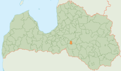
The district of Aizkraukle (Aizkraukles novads) is located in southern Latvia on the Daugava River in the historic Vidzeme landscape .
geography
The southern border of the district is from the Daugava formed which is dammed up here because of the hydroelectric plant Pļaviņas. Otherwise the area is rural.
population
The district consists of the municipality (pagasts) Aizkraukle Land and the administrative center Aizkraukle City . 9,986 inhabitants (2010) live in the Aizkraukle district.
Web links
Commons : Aizkraukle Municipality - Collection of images, videos and audio files

