Ape district
| Ape district | ||
|---|---|---|
 |
||
| Symbols | ||
|
||
| Basic data | ||
| Country | Latvia | |
| Capital | Ape | |
| surface | 545.1 km² | |
| Residents | 4287 (2009) | |
| density | 7.9 inhabitants per km² | |
| founding | 2009 | |
| ISO 3166-2 | LV-009 | |
| Website | www.apesnovads.lv (Latvian) | |
| politics | ||
| Head of government | Astrīda Harju (2013) | |
Coordinates: 57 ° 28 ' N , 26 ° 37' E
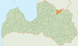
The Ape District (Apes novads) is located in northeastern Latvia in the historic Vidzeme countryside .
geography
The Republic of Estonia borders in the north of the area . The upper reaches of the Gauja flows through the western part of the district near Gaujiena . In addition, Pleskauer Chaussee runs through the district in a west-east direction.
population
The district consists of the three municipalities (pagasts) Gaujiena, Trapene, Vireši and the administrative center Ape . 4287 inhabitants (2009) live in the Ape district.
Web links
Commons : Ape Municipality - Collection of images, videos and audio files
