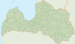
Saulkrasti district
| Saulkrasti district | ||
|---|---|---|
 |
||
| Symbols | ||
|
||
| Basic data | ||
| Country | Latvia | |
| Capital | Saulkrasti | |
| surface | 47.7 km² | |
| Residents | 6165 (2014) | |
| density | 129 inhabitants per km² | |
| founding | 2009 | |
| ISO 3166-2 | LV-089 | |
| Website | www.saulkrasti.lv (Latvian) | |
Coordinates: 57 ° 15 ′ 0 ″ N , 24 ° 25 ′ 0 ″ E
The District Saulkrasti (Saulkrastu novads) is located in Latvia .
geography
The district is located in the north of the country, east of the Bay of Riga .
population
In the course of an administrative reform in 2009, the town of Saulkrasti (with 3280 inhabitants) was combined with its rural community (2885 inhabitants) to form a district. On July 1, 2014, a total of 6165 residents lived here.
Web links
Commons : Saulkrasti Municipality - Collection of images, videos and audio files
