Dobele district
| Dobele district | |||
|---|---|---|---|
 |
|||
| Symbols | |||
|
|||
| Basic data | |||
| Country | Latvia | ||
| Capital | Dobele | ||
| surface | 889.7 km² | ||
| Residents | 24,390 (2010) | ||
| density | 27 inhabitants per km² | ||
| founding | 2009 | ||
| ISO 3166-2 | LV-026 | ||
| Website | www.dobele.lv (Latvian) | ||
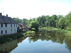
| The river Bērze near Dobele | |||
Coordinates: 56 ° 39 ' N , 23 ° 14' E
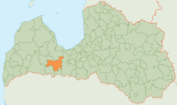
The District Dobele (Dobeles novads) is located in southwestern Latvia in the historic landscape Zemgale .
geography
The Bērze River flows through the area . In addition, the Riga - Liepāja railway line crosses the district in a west-east direction.
population
The district consists of the ten parishes (pagasts):
- Annenieki, (German: Annenhof )
- Auri, (German: Auermünde )
- Bērze, (German: Bershof )
- Biksti, (German: Bixten )
- Dobele (rural community),
- Jaunbērze, (German: Neu Bershof )
- Krimūna,
- Naudīte, ( Eng .: Naudites )
- Penkule, (German: Pankelhof )
- Zebrene (German: Rengenhof )
and the administrative center Dobele (German: Doblen ). 24,390 inhabitants (2010) live in the Dobele district.


