
Bodoc (Covasna)
|
Bodoc Árkos |
|||||
|
|||||
| Basic data | |||||
|---|---|---|---|---|---|
| State : |
|
||||
| Historical region : | Transylvania | ||||
| Circle : | Covasna | ||||
| Coordinates : | 45 ° 57 ' N , 25 ° 51' E | ||||
| Time zone : | EET ( UTC +2) | ||||
| Height : | 549 m | ||||
| Area : | 33.53 km² | ||||
| Residents : | 2,553 (October 20, 2011) | ||||
| Population density : | 76 inhabitants per km² | ||||
| Postal code : | 527035 | ||||
| Telephone code : | (+40) 02 67 | ||||
| License plate : | CV | ||||
| Structure and administration (as of 2016) | |||||
| Community type : | local community | ||||
| Structure : | Bodoc, Olteni , Zălan | ||||
| Mayor : | István Fodor ( UDMR ) | ||||
| Postal address : | Str. Pricipală nr. 65 loc. Bodoc, jud. Covasna, RO-527035 |
||||
| Website : | |||||
| Others | |||||
| City Festival : | in July "Zilele Ecvestre Covăsene" (Kovasnauer Riding Days) | ||||


Bodoc ( Hungarian Sepsibodok or Bodok ) is a municipality in the Covasna district , in the Transylvania region in Romania .
Geographical location

The municipality of Bodoc is located in a valley basin on the upper reaches of the Olt (Alt) river in the southwestern foothills of the Bodoc Mountains and the eastern foothills of the Baraolter Mountains in the historic Szeklerland . In Covasna County, at the mouth of the creek Talomir in the Olt, the National Road Drum naţional 12 - part of the European Route 578 - and the railway Sfântu Gheorghe Adjud , the city Bodoc is eleven kilometers north of the county capital Sfântu Gheorghe (St. Georgen) away .
There are numerous mineral water springs in the municipality .
history
The area of the incorporated village of Olteni (Oltzen) has been populated in the municipality since at least Roman times, to which the Fort Olteni is evidence of an auxiliary troop camp .
The village of Bodoc, mostly inhabited by Szeklern people, was first mentioned in a document in 1332. A settlement of the place on the area by the locals called Pădurea mestecenilor (Hungarian Nyrerdö ), according to information from Hermann Schroller and Márton Roska, was dated to the Neolithic . Also in the incorporated villages of Olteni and Zălan (Hungarian Zalán ) traces of settlements in different ages were assigned. Numerous archaeological finds from the municipality are in the museum of the district capital Sfântu Gheorghe.
At the time of the Kingdom of Hungary , today's municipality belonged to the Sepsi district in the Háromszék County ( Romanian Comitatul Trei-Scaune ). Subsequently, Arcuș belonged to the historical Trei-Scaune district (in German three chairs ) and from 1950 to today's Covasna district.
Because of the numerous mineral water springs in the municipality, there is a filling system here.
Since the bear population is increased in the municipality, there are even three to four times a week to accidents with bears due to the lack of game crossings on roads and railways.
population
The population of the municipality of Bodoc developed as follows:
| census | Ethnic composition | ||||
|---|---|---|---|---|---|
| year | population | Romanians | Hungary | German | other |
| 1850 | 2,523 | 39 | 2,445 | 4th | 35 |
| 1920 | 2,345 | 3 | 2,339 | - | 3 |
| 1941 | 2,728 | 12 | 2,626 | 23 | 67 |
| 1977 | 2,837 | 84 | 2,571 | 5 | 177 |
| 2002 | 2,513 | 86 | 2,420 | - | 7th |
| 2011 | 2,553 | 89 | 2,396 | - | 68 |
Since 1850, the highest number of inhabitants in the area of the municipality of Bodoc was recorded in 1977. The highest number of Magyars (2,730) was registered in 1956, that of Romanians in 2011, of Roma (177) in 1977 and of Romanian Germans in 1941.
Attractions
- In the community center, the Reformed Church, built in the 15th century, renewed in 1651, and the bell tower renewed in the 20th century, according to the Directory of Historical Monuments of the Ministry of Culture and National Heritage (Ministerul Culturii și Patrimoniului Național) are listed.
- In Bodoc the wooden gates of property no. 217 was built in 1934 and that of property no. 218 in 1940, are under monument protection.
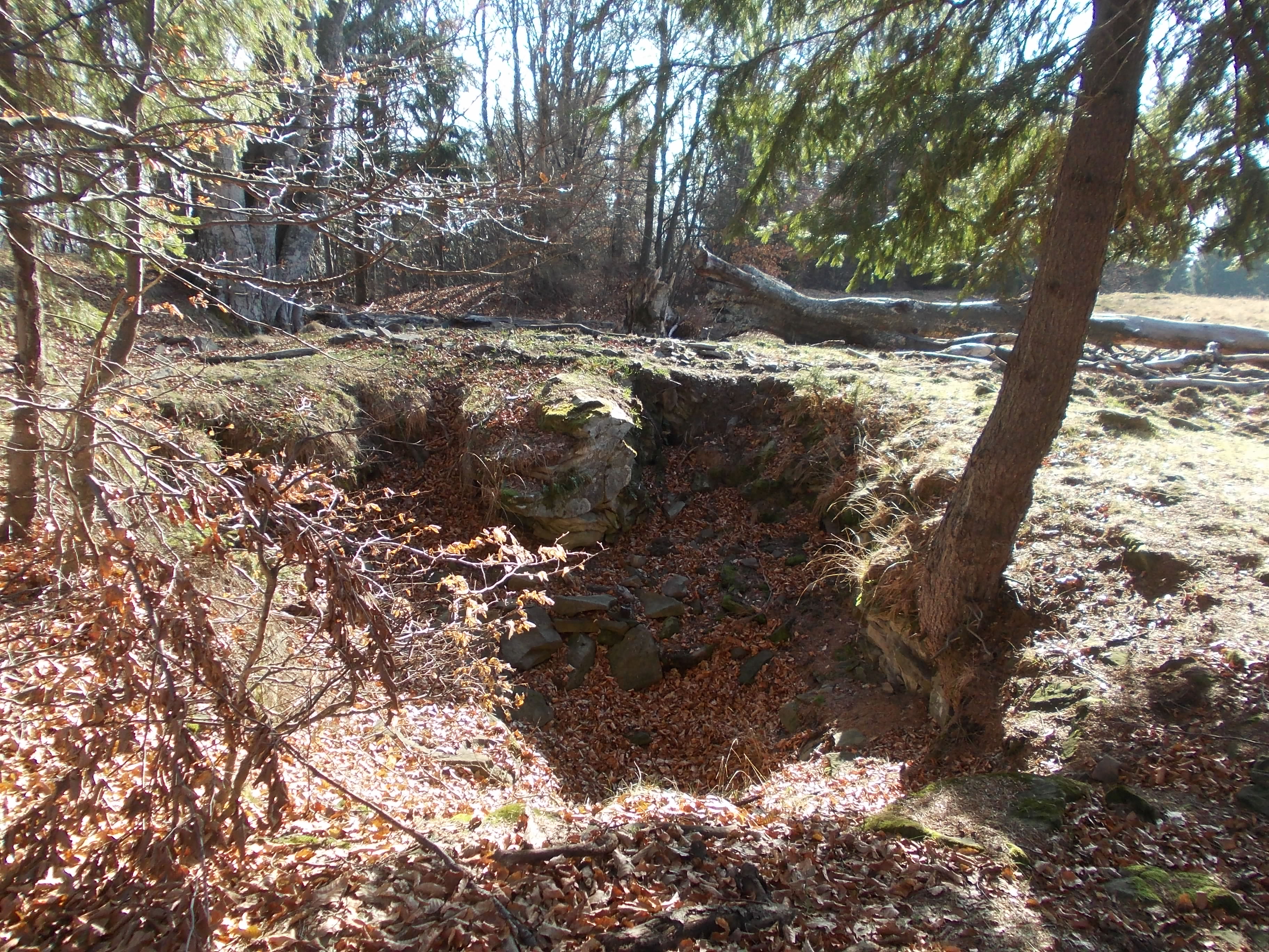
- Northeast of the community center at about seven kilometers the Cetatea Comorii or Vârful Comorii (Hungarian Kincsásvár or Kincsástetö ) ( ⊙ ) on an elevation, according to various statements, of 1053 m or 1195 m was assigned to the Latène period in 1950 . The castle is said to have had an area of about 240 x 170 meters.
- In the incorporated village of Olteni (Hungarian Oltszem ) the country house of the Hungarian noble family Mikó was built in 1827. The property is a listed building.
- Several archaeological sites in the area of the incorporated village of Olteni. A site at a height of 597 m on the left bank of the Olt called Cetatea Fetei by the locals , one near Drumul cu gropi (Hungarian Gödrösút ) and a site at a height of 706 m called Vârful Cetății (Hungarian Vártetö ).
- In the incorporated village of Zălan, the reformed church built in 1319 and renovated in 1825 is a listed building.
Town twinning
The municipality of Bodoc maintains partnerships with the Hungarian municipalities of Tarcal and Detk .
Web links
Individual evidence
- ↑ 2011 census in Romania ( MS Excel ; 1.3 MB).
- ↑ Heinz Heltmann, Gustav Servatius (Ed.): Travel Guide Siebenbürgen . Kraft, Würzburg 1993, ISBN 3-8083-2019-2 , p. 517 .
- ^ A b Institute Of Archeology - Bodoc , accessed November 10, 2019 (Romanian).
- ^ A b Institute Of Archeology - Olteni , accessed on November 10, 2019 (Romanian).
- ↑ Olteni / Comuna: Bodoc. 2006, accessed November 10, 2019 (Romanian).
- ↑ Institute Of Archeology - Zalan , accessed on November 10, 2019 (Romanian).
- ↑ Ioana: Urs lovit mortal de un tren la Bodoc. Realitatea de Covasna, November 7, 2019, accessed November 10, 2019 (Romanian).
- ↑ Censuses 1850–2002, last updated November 2, 2008 (PDF; 1 MB; Hungarian).
- ↑ a b c d e List of historical monuments of the Romanian Ministry of Culture , updated 2015 (PDF; 12.7 MB; Romanian).
- ^ Image of the remains of the wall at Wikimapia
- ↑ Information and pictures of the Mikó country house in Olteni on the municipality's website, accessed on November 10, 2019.
- ↑ Information on Landhaus Mikó in Olteni from castleintransylvania.ro , accessed on November 10, 2019 (English, Hungarian, Romanian).
- ↑ Olteni - Cetatea Fetei , on ironageatlas.net4u.ro , accessed on November 10, 2019 (Romanian).
Aita Mare | Arcuș | Barcani | Bățani | Belin | Bixad | Bodoc | Boroșneu Mare | Brateș | Brăduț | Brețcu | Catalina | Cernat | Chichiș | Comandău | Dalnic | Dobârlău | Estelnic | Ghelința | Ghidfalău | Hăghig | Ilieni | Lemnia | Malnaș | Mereni | Micfalau | Moacșa | Ojdula | Ozun | Poian | Reci | Sânzieni | Sita Buzăului | Turia | Valea Crișului | Valea Mare | Vâlcele | Vârghiș | Zagon | Zabala