
Bolu (province)
| Bolu | |
|---|---|
| Province number: | 14th |
  |
|
| Counties | |
 |
|
| Basic data | |
| Coordinates: | 40 ° 41 ′ N , 31 ° 33 ′ E |
| Provincial capital: | Bolu |
| Region: | Black Sea Region |
| Surface: | 8313 km² |
| Population: | 311,810 (2018) |
| Population density: | 29 inhabitants / km² |
| Political | |
| Governor: | Ahmet Ümit |
| Seats in Parliament: | 3 |
| Structural | |
| Telephone code: | 0374 |
| Features : | 14th |
| Website | |
| www.bolu.gov.tr (Turkish) | |
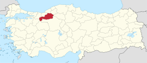
Bolu is a province of Turkey . Its capital is Bolu .
The province borders on the provinces of Ankara , Bilecik , Sakarya , Düzce , Zonguldak , Eskişehir and Karabük .
population
Population projection
The following table shows the annual population development at the end of the year after updating by the addressable population register (ADNKS) introduced in 2007. In addition, the population growth rate and are gender relations ( sex ratio h. Number of women per 1,000 men d.) Listed.
The 2011 census found 276,976 inhabitants, which is around 6,300 more than in the 2000 census.
| year | Population at the end of the year | Population growth rate (in%) |
Gender ratio (women per 1000 men) |
Rank (among 81 provinces) |
||
|---|---|---|---|---|---|---|
| total | male | Female | ||||
| 2018 | 311.810 | 154.711 | 157.099 | 2.85 | 1015 | 59 |
| 2017 | 303.184 | 150.383 | 152.801 | 1.10 | 1016 | 59 |
| 2016 | 299,896 | 148,481 | 151.415 | 3.02 | 1020 | 59 |
| 2015 | 291,095 | 144.501 | 146,594 | 2.21 | 1014 | 60 |
| 2014 | 284,789 | 140.405 | 144.384 | 0.46 | 1028 | 61 |
| 2013 | 283,496 | 140,572 | 142.924 | 0.86 | 1017 | 61 |
| 2012 | 281.080 | 139,805 | 141,275 | 1.65 | 1011 | 61 |
| 2011 | 276.506 | 137.385 | 139.121 | 1.95 | 1013 | 61 |
| 2010 | 271.208 | 133,958 | 137,250 | −0.12 | 1025 | 62 |
| 2009 | 271,545 | 135.227 | 136,318 | 0.99 | 1008 | 62 |
| 2008 | 268,882 | 134.056 | 134,826 | −0.57 | 1006 | 62 |
| 2007 | 270.417 | 134.502 | 135.915 | - | 1011 | 62 |
| 2000 1 | 270,654 | 137.153 | 133.501 | 973 | 62 | |
1 2000 census
Census results
The following tables show the population of Bolu Province documented in the 14 censuses .
The values in the table on the left are taken from e-books (from the original documents), the values in the table on the right come from the data query of the Turkish statistical institute TÜIK - available on this website:
| year | population | rank | |
|---|---|---|---|
| province | Turkey | ||
| 1927 | 218.246 | 13,648,270 | 23 |
| 1935 | 248.027 | 16.158.018 | 31 |
| 1940 | 257.393 | 17,820,950 | 32 |
| 1945 | 276,367 | 18,790,174 | 33 |
| 1950 | 303.111 | 20,947,188 | 31 |
| 1955 | 317,946 | 24,064,763 | 35 |
| 1960 | 353.004 | 27,754,820 | 37 |
| year | population | rank | |
|---|---|---|---|
| province | Turkey | ||
| 1965 | 383,939 | 31,391,421 | 37 |
| 1970 | 403.766 | 35.605.176 | 38 |
| 1975 | 218,305 | 40,347,719 | 63 |
| 1980 | 228.702 | 44,736,957 | 64 |
| 1985 | 504.778 | 50,664,458 | 39 |
| 1990 | 536.869 | 56.473.035 | 38 |
| 2000 | 270,654 | 67,803,927 | 62 |
Number of provinces in relation to the census years:
- 1927, 1940 to 1950: 63 provinces
- 1935: 57 provinces
- 1955: 67 provinces
- 1960 to 1985: 73 provinces
- 1990: 73 provinces
- 2000: 81 provinces
Administrative division
The province is divided into nine districts ( İlçe ) :
| district | Area 1 (km²) |
Population (2018) 2 | Number of Units | Density (Ew / km²) |
urban share (in%) |
Gender ratio 3 |
Founding date 4.5 |
|||
|---|---|---|---|---|---|---|---|---|---|---|
| district | Administrative headquarters (Merkez) |
Municipalities (Belediye) |
District (Mahalle) |
Villages (Köy) |
||||||
| Dörtdivan | 634 | 7.139 | 2,993 | 1 | 8th | 24 | 11.26 | 41.92 | 1060 | May 20, 1990 |
| talk | 1,060 | 34,277 | 23,038 | 1 | 8th | 92 | 32.34 | 67.21 | 1014 | |
| Goynuk | 1,407 | 15,423 | 4.183 | 1 | 6th | 66 | 10.96 | 27.12 | 985 | |
| Kıbrıscık | 562 | 3,220 | 1,193 | 1 | 2 | 22nd | 5.73 | 37.05 | 1005 | 04/01/1958 |
| amounts | 874 | 14,355 | 5,551 | 2 | 8th | 56 | 16.42 | 53.74 | 986 | 01/01/1948 |
| Merkez | 1,616 | 205,525 | 171.180 | 2 | 44 | 112 | 127.18 | 84.34 | 1021 | |
| Mudurnu | 1.314 | 19,327 | 5.123 | 2 | 12 | 70 | 14.71 | 38.12 | 986 | |
| Seben | 683 | 5,250 | 2,440 | 1 | 2 | 29 | 7.69 | 46.48 | 1097 | 04/01/1946 |
| Yeniçağa | 163 | 7,294 | 4,573 | 1 | 3 | 16 | 44.75 | 62.70 | 988 | May 20, 1990 |
| PROVINCE Bolu | 8,313 | 311.810 | 12 | 93 | 487 | 37.51 | 72.75 | 1015 | ||
swell
1 area in 2014
two population projection on December 31, 2018
3 sex ratio (Sex Ratio): Number of women per 1000 men (calculated)
4 PDF file of the Interior Ministry
five counties, the first to have been formed Foundation of Turkey (1923).
Web links
Individual evidence
- ↑ Türkiye Nüfusu İl ve İlçelere Göre Nüfus Bilgileri , accessed on May 18, 2019
- ^ Website of the Bolu Province
- ↑ Genel Nüfus Sayımları (census results 1965 to 2000)
- ↑ Directorate General of Mapping PDF file 0.25 MB
- ↑ Türkiye Nüfusu İl İlçe Mahalle Köy Nüfusu , accessed on May 18, 2019
- ↑ [1] TARİH (1) .pdf 1.4 MB
Adana | Adıyaman | Afyonkarahisar | Ağrı | Aksaray | Amasya | Ankara | Antalya | Ardahan | Artvin | Aydın | Balıkesir | Bartın | Batman | Bayburt | Bilecik | Bing oil | Bitlis | Bolu | Burdur | Bursa | Çanakkale | Çankırı | Çorum | Denizli | Diyarbakır | Düzce | Edirne | Elazığ | Erzincan | Erzurum | Eskişehir | Gaziantep | Giresun | Gümüşhane | Hakkâri | Hatay | Iğdır | Isparta | İstanbul | İzmir | Kahramanmaraş | Karabük | Karaman | Kars | Kastamonu | Kayseri | Kırıkkale | Kırklareli | Kırşehir | Kilis | Kocaeli | Konya | Kutahya | Malatya | Manisa | Mardin | Mersin | Muğla | Muş | Nevşehir | Niğde | Ordu | Osmaniye | Rize | Sakarya | Samsun | Siirt | Sinop | Sivas | Şanlıurfa | Şırnak | Tekirdağ | Tokat | Trabzon | Tunceli | Usak | Van | Yalova | Yozgat | Zonguldak