Burgstein
Burgstein was a municipality in the Vogtlandkreis in Saxony . In 1994 it was formed from the places Geilsdorf , Großzöbern , Gutenfürst , Heinersgrün , Kemnitz , Krebes and Schwand with their respective districts. In 1999 Dröda was incorporated. On January 1, 2011, it was incorporated into the neighboring community of Weischlitz , with all the districts , with which the Weischlitz administrative community had previously existed.
geography
Burgstein is about 12 kilometers southwest of Plauen and about 13 kilometers northeast of Hof . The north of the municipality is crossed by the upper reaches of the White Elster .
geology
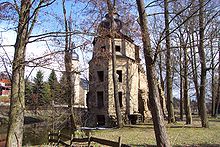
The castle stone, after which the community is named, is one of the typical elevations of the Vogtland hilltop land. It consists of a volcanic Paläobasalt breccia of Upper Devonian ( Erdaltzeit ) and is 546 m above sea level. NN high. The ruins of two late medieval churches standing close together have been preserved there. The hiking area around the Burgstein is a landscape protection area and parts of it are located in the Green Belt , the former border protection strip of the GDR.
Community structure
The following districts belonged to Burgstein:
|
|
history
The Burgstein and the Burgstein ruins
Located in the west of the Vogtland, the places around the Burgstein were owned by the von Sack family from the Vogtland in the 14th century . There is archival evidence of a noble residence on the Burgstein for at least the 1420s (“… that [Edel-] Lewt was sitting at Burckstein [,] they were called the Pucher”).
In 1474 a pilgrimage arose after an apparition of Mary , combined with the construction of a pilgrimage chapel (today western castle stone ruins), which belonged to the parish of the neighboring village of Krebes and as a so-called dispute parish thus to the diocese of Bamberg . Not least the location directly on the border of the dioceses of Bamberg and Naumburg led to long-term disputes between the two over the presumably considerable income from pilgrimages, which were contractually settled in 1487.
The construction of the second, eastern Burgstein church is to be seen in connection with the elevation to an independent parish in 1489 (it would therefore have been the parish church of the new parish). In the years 1512 and 1512, Elector Friedrich the Wise (1463–1525), the sovereign responsible, donated Burgstein textile furnishings. With the implementation of the Reformation in Vogtland and the associated rejection of the Catholic pilgrimage practice, the decline of the double church began. In 1540, the Saxon Elector Johann Friedrich ordered the demolition of both Burgstein sacred buildings, which were not completely demolished but left to decay. The members of the Burgstein parish were referred to the church in the neighboring village of Geilsdorf.
Regarding the manorial rule , the castle stone in the corridor of Ruderitz belonged to the Geilsdorf manor in the Electoral Saxon or Royal Saxon Office of Plauen . The Vogtland official border ran through the Burgstein area until the 19th century. While the northern places Geilsdorf, Grobau, Gutenfürst, Kemnitz, Krebes with Schwarzenreuth, Ruderitz, Schwand and Steins belonged to the Plauen office, the southern places Berglas, Großzöbern, Kleinzöbern, Dröda, Heinersgrün with Marxgrün, Pirk and Türbel were administered by the Voigtsberg office. In 1856, Ruderitz and the Burgstein district became part of the Plauen court office and, in 1875, the Plauen authorities .
In the age of romanticism , the castle stone with its two ruins was rediscovered in the 19th century. An inn built on the Burgstein in 1875/77 increased the attractiveness of the place considerably until the beginning of the 1950s and was the meeting point of an illustrious group of artists around the Vogtland painter and graphic artist Hermann Vogel , especially at the beginning of the 20th century . With the establishment of the restricted area on the inner-German border , the Burgstein area , which had previously been popular with tourists, was no longer accessible. The last host family on the Burgstein was evicted in 1952 . Only with the fall of the Berlin Wall did the situation in the restricted area end for the Burgstein area.
The municipality of Burgstein
Named after the castle stone with its striking church ruins, the municipality of Burgstein was formed in 1994 from the places Geilsdorf , Großzöbern , Gutenfürst , Heinersgrün , Kemnitz , Krebes and Schwand with their respective districts. In 1999 Dröda was incorporated. On January 1, 2011, the municipality of Burgstein and all of its districts were incorporated into the neighboring municipality of Weischlitz , with which the Weischlitz administrative community had previously existed.
Special features of the individual districts of Burgstein

- Krebes : In the village of Krebes, next to a small museum room, there is the house of Hermann Vogel (1854–1921), who became known in the successor to Ludwig Richter for his book and fairy tale illustrations, especially by the Braun & Schneider publishing house in Munich. In the house there is a branch of the Vogtland Museum Plauen with a permanent exhibition on the life and work of Hermann Vogel.
- Ruderitz : From the Burgstein a path leads through the Kemnitzbachtal to the Kienmühle, a grinding and cutting mill built in the 17th century. In the village of Ruderitz there is a restored inn from the 18th century.
- Geilsdorf : in Geilsdorf you can see the restored ruins of a moated castle and an artesian thermal well.
- Heinersgrün : On a hill above the village of Heinersgrün stands St. Clara, the grave chapel of the von Feilitzsch and von Pöllnitz families from the late Middle Ages, visible from afar .
- Gutenfürst : During the division of Germany there was a border crossing in Gutenfürst (see also Gutenfürst station ). At the beginning of October 1989, several special trains with GDR citizens passed this border crossing every day . Her arrival in West Germany received a lot of media attention.
- Disappeared places in the former border area : The village of Ramoldsreuth existed in the former municipality of Burgstein until the 1960s , a square village with Waldhufenflur , which was incorporated into Großzöbern in 1968 and demolished as a result of the construction of the Feilebach dam . The Markusgrün part of Heinersgrün was eliminated as a result of the border security measures of the GDR . The hamlet of Schwarzenreuth belonging to Krebes was also in the restricted area.
Population development
(always on December 31st) :
|
|
- Data source: Saxony State Statistical Office
Memorials
- The graves are located in the cemetery of the Großzöbern district and at the exit of Pirk a memorial stone commemorates five Jewish concentration camp prisoners who were killed by SS men in Pirk in April 1945 during the death march from the Sonneberg concentration camp , a satellite camp of the Buchenwald concentration camp were murdered.
Culture and sights
Castle stone ruins
The ruins of the pilgrimage and parish church are cultural monuments and popular hiking destinations. They were restored in the 1990s on behalf of the city of Plauen. The masonry was covered with mortar and the wall crowns were given rounded concrete heads. In the area in and around the ruins, the tree growth was removed. The interior is secured by galvanized steel bar doors. Access is only possible for events. There has been an association called Burgstein-er-Leben e. V. which has set itself the task of enlivening the environment; Guided tours are offered there with advance notice.
The churches were built by the dioceses of Bamberg and Naumburg, this was made possible by the location near the diocese borders and supported by Kasper Sack zu Geilsdorf. Due to an apparition of Mary by two miners, a fortified church was first built there, which was later expanded. When the diocese of Naumburg heard of the high number of visitors, the second church was commissioned. In the course of the Reformation , the churches were burned down and forgotten. It was not until the Romantic era that they were revived under Hermann Vogel and his friends.
The Burgstein was closed again by the restricted zone in the border area between the GDR and the Federal Republic of Germany. Access was impossible for most of the population. This only changed with the opening of the border on November 9, 1989.
- Castle stone ruins
traffic

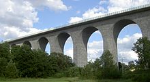
In the area of the municipality, the A 72 motorway runs with the junction in Pirk and the famous Elstertal bridge .
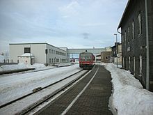
The municipal area is crossed from northeast to southwest by the Leipzig – Hof railway line . There are stops in Grobau and Gutenfürst. The Gutenfürst station was important as a border station for interzonal trains during the Soviet Zone / GDR .
Sons and daughters of the church
- Hermann Vogel (1854–1921), painter, lived and died in Krebes
- Paul Hartwig (1915-2014), the vice-admiral of the German Navy and commander of the fleet was on September 14, 1915, Stone was born, a part of the former town of Burg Stein, held today in the municipality Weischlitz is incorporated
- Siegfried Rudert (1932–1980), mechanical engineer and professor for automation technology / control technology , born in Großzöbern
literature
- Heinz Mocker : Register for the parish registers of the Großzöbern parish 1642–1912. Copy of the manuscript . Plauen 1987, according to the inventory part IV of the German Central Office for Genealogy , p. 542
Individual evidence
- ↑ Martina Bundszus, New documents on the old castle stone - A pilgrimage church complex in the field of tension between territorial interests . In: The Vogtland. Text on the culture and history of the Vogtland, issue 2006, Plauen 2006, pp. 9–57. ISBN 3-928828-37-1 . - Martina Bundszus, more about the Burgstein. An addendum to the article "New documents on the old castle stone - a pilgrimage church complex in the field of tension between territorial interests"; (Issue 3/2006) . In: das Vogtland, text on culture and history of the Vogtland, issue 2009, Plauen 2009, pp. 30–35. ISBN 978-3-928828-48-2 .
- ↑ Geilsdorf Castle on Sachsens-Schlösser.de
- ^ Karlheinz Blaschke , Uwe Ulrich Jäschke : Kursächsischer Ämteratlas. Leipzig 2009, ISBN 978-3-937386-14-0 ; P. 76 f.
- ↑ Historical place directory of Saxony
- ^ The Plauen District Administration in the municipality register 1900
- ^ Rolf Ketzel, The Burgstein hosts and their guests , Plauen 2004. ISBN 3-928828-30-4 .
- ↑ Frank Weiß, Painting in the Vogtland. Images and painters from nine centuries (Leipzig 2002) pp. 35–36. ISBN 3-363-00775-2 .
- ↑ zeit.de: GDR citizens board the trains to freedom
- ↑ mdr.de September 29, 2019: Locomotive of the first refugee train is still in use
- ↑ The history of the Markusgrün settlement
- ↑ Schwarzenreuth in the Digital Historical Directory of Saxony
Web links
- Burgstein in the Digital Historical Directory of Saxony
- Pictures of the ruins and of the 3D reconstruction of the churches
Coordinates: 50 ° 25 ′ 9 ″ N , 11 ° 59 ′ 6.9 ″ E


