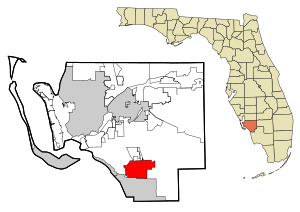
Estero
| Estero | |
|---|---|
|
County and state location
|
|
| Basic data | |
| State : | United States |
| State : | Florida |
| County : | Lee County |
| Coordinates : | 26 ° 26 ′ N , 81 ° 49 ′ W |
| Time zone : | Eastern ( UTC − 5 / −4 ) |
| Residents : | 22,612 (as of 2010) |
| Population density : | 434.8 inhabitants per km 2 |
| Area : | 52 km 2 (approx. 20 mi 2 ) of which 52 km 2 (approx. 20 mi 2 ) are land |
| Height : | 4 m |
| Postal code : | 33928 |
| Area code : | +1 239 |
| FIPS : | 12-21150 |
| GNIS ID : | 0282257 |
Estero is a census-designated place (CDP) in Lee County in the US state of Florida with 22,612 inhabitants (as of 2010).
geography
Interstate 75 and the Tamiami Trail ( US 41 ) run through Estero . The CDP borders directly to the north on Bonita Springs and is about 14 km south of Fort Myers . Miami is 130 miles and Tampa is 130 miles away.
history
In 1904 the Atlantic Coast Line Railroad built a railway line from Punta Gorda to Fort Myers, which was extended in 1925 via Estero to Bonita Springs and in 1926 to Naples . Today the route from Arcadia via Punta Gorda and Fort Myers to Naples is operated by the Seminole Gulf Railway .
Demographic data
According to the 2010 census, the then 22,612 inhabitants were distributed over 18,479 households. The population density was 434.8 inh / km². 95.2% of the population identified themselves as whites , 1.0% as African American , 0.1% as Indians and 1.3% as Asian Americans . 1.4% said they belonged to another ethnic group and 0.9% to several ethnic groups. 5.9% of the population were Hispanics or Latinos .
In 2010 children under 18 years of age and 54.7% of all households lived in 10.3% of all households with persons at least 65 years of age. 66.5% of households were family households (consisting of married couples with or without offspring or a parent with offspring). The average household size was 2.01 people and the average family size was 2.34 people.
10.6% of the population were younger than 20 years old, 15.1% were 20 to 39 years old, 19.5% were 40 to 59 years old, and 54.7% were 60 years or older. The mean age was 62 years. 48.0% of the population were male and 52.0% were female.
The median annual income was $ 62,031, with 6.0% of the population living below the poverty line.
In 2000, English was the mother tongue of 93.62% of the population, 3.13% spoke Spanish and 3.25% had another mother tongue.
Attractions
On May 4, 1976, the Koreshan Unity Settlement Historic District was inscribed on the National Register of Historic Places .
Personalities
- Jordan Burgess (* 1994), volleyball player
Individual evidence
- ^ Gregg Turner: A Short History of Florida Railroads. Arcadia Publishing , Mount Pleasant 2014, ISBN 978-1-439642-54-2 .
- ^ Profile of General Population and Housing Characteristics: 2010 . United States Census Bureau . Retrieved April 15, 2013.
- ↑ Language distribution 2000 . Modern Language Association . Retrieved April 15, 2013.
- ↑ FLORIDA - Lee County. National Register of Historic Places , accessed July 29, 2015 .

