
Frastanz
|
market community Frastanz
|
||
|---|---|---|
| coat of arms | Austria map | |
 |
|
|
| Basic data | ||
| Country: | Austria | |
| State : | Vorarlberg | |
| Political District : | Feldkirch | |
| License plate : | FK | |
| Surface: | 32.26 km² | |
| Coordinates : | 47 ° 13 ' N , 9 ° 37' E | |
| Height : | 510 m above sea level A. | |
| Residents : | 6,503 (January 1, 2020) | |
| Population density : | 202 inhabitants per km² | |
| Postal code : | 6820 | |
| Area code : | 05522 | |
| Community code : | 8 04 05 | |
| NUTS region | AT342 | |
| Address of the municipal administration: |
Sägenplatz 1 6820 Frastanz |
|
| Website: | ||
| politics | ||
| Mayor : | Walter Gohm ( ÖVP ) | |
|
Local council : ( 2015 ) (27 members) |
||
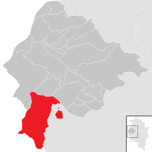
| Location of Frastanz in the Feldkirch district | ||
  |
||
 Frastanz with parish church |
||
| Source: Municipal data from Statistics Austria | ||

Frastanz is a market town with 6503 inhabitants (as of January 1, 2020) in the Feldkirch district in the Austrian state of Vorarlberg .
geography
Frastanz is located in the Feldkirch district in Vorarlberg, Austria's westernmost state, at an altitude of 510 meters. 61.2 percent of the area is forested. The Samina flows into the Ill at Frastanz .
Nature reserves
- European protected area Spirkenwälder Saminatal
- Frastanzer Ried (natural monument and protected parts of the landscape)
- Maria-Grüner Ried (nature reserve)
Community structure
The districts of the municipality are:
- Hofen
- Einlis
- Amerlügen (229 inhabitants)
- The Amerlügen parcel is located on a terrace on the eastern slope of the Vorderälpel at around 760 meters above sea level.
- Fellengatter (1,400 inhabitants) Fellengatter is the largest plot of land in the village and the earliest traces of settlement from prehistoric times can be found in the Fellengattner area of Stadtschrofens.
- Soil forest
- Frastafeders (252 inhabitants) The Frastafeders parcel is located on a south-facing slope terrace - seen from the village of Frastanz - at an altitude of 560 to 590 m. The Frastafeders castle in Klöslefeld (near the castle), which has been mentioned several times in a document, was clearly archaeologically proven by the excavations under Wilhelm Sydow .
- Gampelün (238 inhabitants)
- Gampelün is located southeast of Frastanz on sloping terraces at around 700 meters above sea level as an enclave in the municipal area of Nenzing . The name "Gampelü" appears for the first time in 1365 in the Frastanzer documents. It includes the districts of Winkel, Oberes Gampelün, Rofel, Kosa, Bardella, Anderhalden and Galätscha.
- Sonnenheim
- Bardella
Neighboring communities
The neighboring communities are in the northwest Feldkirch , in the north Göfi , in the northeast Sattein , in the east Nenzing with an enclave there, ,,,
history
Frastanz is on a Roman road . The Habsburgs ruled the places in Vorarlberg alternately from Tyrol and Upper Austria ( Freiburg im Breisgau ).
Frastafeders Castle was probably built around 1258 in the wake of the first Montfort line division as an outpost of the Counts of Werdenberg against Feldkirch. In addition, she probably had the task of securing the path over the Sarojajoch.
It is not known which family of Werdenberg servants sat on Frastafeders in the 13th century. In 1317, Count Rudolf II von Werdenberg-Sargans lent the castle to the imperial knight Ulrich Thumb von Neuburg.
Frastafeders Castle did not even exist for a hundred years. It was destroyed as early as 1344 as part of a dispute between the Counts of Montfort-Feldkirch.
The Battle of Frastanz took place on Frastanzer Boden in 1499 , one of the bloodiest and most important decisive battles of the Swabian War. From 1805 to 1814 the place belonged to Bavaria, then again to Austria.
Frastanz was under the rule of Sonnenberg for a long time . In earlier times Frastanz and Nenzing formed a kind of double community. Until the 18th century, both communities were a tax unit as small gnos under the Bruges . Ecclesiastically, the Nenzing districts of Motten, Mariex and Mittelberg have belonged to Frastanz since 1785.
On June 15, 1910, the Ill broke through the dams in three places and transformed the Frastanzer Ried into a single lake.
For Austrian province of Vorarlberg Frastanz heard since its founding in 1861. The place was 1945-1955 part of the French zone of occupation in Austria .
Population development

For 2003, the proportion of foreigners was 17.8 percent.
The decline in the number of inhabitants from 2001 to 2011 is due to a negative migration balance .
Culture and sights


- Catholic parish church Frastanz hl. Sulpitius: The church was built in 1885 according to the plan of the Cologne and Vienna cathedral builder Friedrich von Schmidt and, together with the parish church in Silbertal by the same architect, is one of the most beautiful neo-Gothic examples in Western Austria. The architect succeeded in reconciling the structural qualities of the Gothic with the Alpine topography. One could speak of a scenic beauty of these buildings that contains something of the spirit of the pictures of the Danube School . In both cases, the elevated location reinforces the gestural symbolism of the Gothic .
- Several listed chapels belong to the parish (examples): Chapel St. Wendelin Frastanz , Chapel Amerlügen , Chapel Maria Ebene , Chapel Klöslefeld .
- Letzehof Buddhist Monastery: The Letzehof Buddhist Monastery (Tashi Rabten), the first Buddhist monastery in Austria , has been located directly on the municipal border with Feldkirch in Maria Grün (Frastanz) . In the succession of the Tibetan master Geshe Rabten, it belongs to the greatest tradition of Tibetan Buddhism . Ordained from Asia and Europe receive their training here, as well as in the other places belonging to the Rabten Foundation, such as the Mother Temple (Rabten Choeling) on Lake Geneva. The management of the monastery is incumbent on the Austrian monk, Gelong Dschampa Lungtog. The Letzehof is often visited by teachers, school classes and other interested groups to get authentic information on the subject of Buddhism .
Museums
- Vorarlberg Electric Museum
- Vorarlberg State Fire Brigade Museum
- Vorarlberg Museum World
- Vorarlberg Tobacco Museum
Economy and Infrastructure
In the district of Fellengatter , tobacco cultivation and hemp rope mill used to be the basis of life. In 2003 there were 117 commercial enterprises with 1,687 employees and 122 apprentices on site. There were 2,533 employees subject to wage tax.
Companies
traffic
- Train: The Frastanz stop is on the Lindau – Bludenz railway line, S1 trains stop .
- Street: Feldkirch city tunnel
education
There are three schools and four kindergartens in Frastanz:
- Frastanz-Hofen elementary school
- Fellengatter elementary school
- Vorarlberg middle school Frastanz
- Kindergarten Amerlügen
- Kindergarten Einlis
- Kindergarten Fellengatter
- Kindergarten Hofen
health
- Maria Ebene Hospital for addictions
- Felsenau swimming pool
politics
The community council has a total of 27 members.
- With the municipal council and mayoral elections in Vorarlberg in 2000, the municipal council had the following distribution: 16 ÖVP, 6 FPÖ and 5 SPÖ.
- With the municipal council and mayoral elections in Vorarlberg in 2005, the municipal council had the following distribution: 15 ÖVP, 8 SPÖ and 4 FPÖ.
- With the municipal council and mayoral elections in Vorarlberg 2010 , the municipal council had the following distribution: 14 ÖVP, 6 SPÖ, 4 FPÖ and 3 Greens.
- With the municipal council and mayoral elections in Vorarlberg 2015 , the municipal council has the following distribution: 14 ÖVP, 5 Greens, 5 FPÖ, 2 SPÖ and 1 BFF citizens' list for Frastanz.
mayor
- 2004–2019 Eugen Gabriel (ÖVP)
- since 2019 Walter Gohm (ÖVP)
coat of arms
The municipal coat of arms was created in 1968 based on a design by the Schruns artist and heraldist Konrad Honold .
The coat of arms was awarded by the Vorarlberg state government on May 2, 1969. It shows "In blue above a golden sun, below a silver horn turned to the left with black fittings and black cord". The symbol of the horn is reminiscent of a legend that is said to have taken place on the occasion of the bloody battle of Frastanz in 1499: A shepherd boy on Amerlügen is said to have noticed a detour and unexpectedly approaching detachment of the Confederates and to warn his compatriots with his horn until he fell dead to the ground. The sun in blue shows that it belongs to the county of Sonnenberg .
Personalities
- Meinrad Tiefenthaler (born March 21, 1902 in Frastanz; † August 21, 1986 in Gurtis ), historian and archivist
- Adalbert Welte (born June 30, 1902 in Frastanz, † July 9, 1969 in Hard ), writer and civil servant
- Bruno Wiederin (born August 24, 1912 in Schruns ; † September 24, 1995 in Frastanz), teacher and composer
- Hubert Gorbach (born July 27, 1956 in Frastanz), former Vice Chancellor
- Markus Wallner (born July 20, 1967 in Bludenz ), Governor of Vorarlberg
Web links
- Web presence of the market town of Frastanz
- 80405 - Frastanz. Community data, Statistics Austria .
Individual evidence
- ↑ a b c d Figures & data: Market town of Frastanz. Retrieved September 4, 2019 .
- ^ History , website of the municipality of Frastanz.
- ↑ Statistics Austria, A look at the community of Frastanz, population development. Retrieved March 26, 2019 .
- ↑ http://www.frastanz.at/Startseite/InstitutionenEinrichtungen/BuddhistischesKloster/tabid/239/Default.aspx/ Accessed on December 22, 2008
- ↑ Marktgemeinde Frastanz: Education
- ↑ Frastanz: These are the new mayor's plans. In: Vorarlberg Online (VOL.at). June 28, 2019, accessed June 28, 2019 .
- ↑ Cornelia Albertani, Ulrich Nachbaur: Vorarlberg municipal coat of arms registry . Ed .: Vorarlberger Landesarchiv. 3. Edition. Bregenz 2011, ISBN 978-3-902622-17-4 , pp. 26 ( vorarlberg.at [PDF]).
