
Fisibach
| Fisibach | |
|---|---|
 |
|
| State : |
|
| Canton : |
|
| District : | Zurzach |
| BFS no. : | 4306 |
| Postal code : | 5467 |
| Coordinates : | 673 033 / 268322 |
| Height : | 382 m above sea level M. |
| Height range : | 332–603 m above sea level M. |
| Area : | 5.77 km² |
| Residents: | 513 (December 31, 2019) |
| Population density : | 89 inhabitants per km² |
|
Proportion of foreigners : (residents without citizenship ) |
31.4% (December 31, 2019) |
| Website: | www.fisibach.ch |
 Fisibach |
|
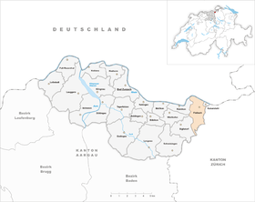
| Location of the municipality | |
  |
|
Fisibach ( Swiss German : ˈfɪʓiˌbɑχ ) is a municipality in the Swiss canton of Aargau . It belongs to the Zurzach district and is located on the Upper Rhine on the border with Germany and the canton of Zurich .
geography
The village is about one kilometer south of the Rhine . It is named after the stream of the same name, which flows from south to north and flows into the river. The valley of the Fisibach , the Bachsertal , is almost two hundred meters wide and is bordered on both sides by gravel terraces typical of the Central Plateau, which were created in the early Pleistocene by medium moraine material . In the municipality of Fisibach, these are the Sanzenberg ( 552 m above sea level ) in the east and the mountain ( 603 m above sea level ) in the west. Both are extremely steep in the lower area and merge into elongated plateaus. There is a clay pit on the slope of the Sanzenberg . To the north and east of the village extends the wide Rhine plain, which is bounded in the west by the Rietbuck ( 461 m above sea level ) and narrows to a narrow strip. Fisibach has no actual village center, the houses are around a large meadow in the center. About one and a half kilometers south of the village is the hamlet of Hägelen ( 405 m above sea level ), southwest of it, on a small terrace directly on the canton border, the hamlet of Waldhausen ( 495 m above sea level ).
The area of the municipality is 577 hectares , of which 264 hectares are forested and 50 hectares are built over. The highest point is at 601 meters on the plateau of the mountain, the lowest at 334 meters on the Rhine. Neighboring communities are Hohentengen in the north, Kaiserstuhl in the northeast, Weiach in the east, Bachs in the southeast, Siglistorf in the southwest, Wislikofen in the west and Rümikon in the northwest.
history
Individual finds testify to a settlement in the area during the Bronze Age around 4000 to 2800 years ago. The Romans built a watchtower on the Rhine around 370, after the river had been established as the northern border of the empire. However, the Romans gave up the border fortifications as early as the first decade of the 5th century when they retreated across the Alps. The Alamanni later settled the area. Fusibach was first mentioned in 1050. Later the place was named Nider-Visibachs and differentiated from Obervisibachs (today part of the municipality of Bachs in the canton of Zurich ). The place name comes from the Old High German Funsinbah and means "Bach des Funso".
The noble von Waldhausen owned a small castle near the hamlet of the same name , but it was called the Burgstall as early as 1471 and nothing has survived today. The nobles donated the Wislikofen priory in 1113 and donated extensive property to the St. Blasien monastery for this purpose. Schwarzwasserstelz Castle stood on an island in the Rhine, but its ruins were demolished in 1875. The Lords of Wasserstelz exercised the lower jurisdiction over Fisibach, from 1363 the diocese of Constance . The blood jurisdiction was also owned by the diocese.
The confederates conquered Aargau in 1415 and Fisibach now belonged to the Kaiserstuhl office of the county of Baden , a common rule . The bailiff moved the lower jurisdiction over Waldhausen and Hägelen to himself, that over Fisibach came in 1589 to the Tschudi family from Glarus . Although a chapel had existed since the 17th century, the residents of Fisibach were in the church until 1842 after Hohentengen , and since then in Kaiserstuhl. In March 1798 the French took Switzerland and proclaimed the Helvetic Republic . Fisibach was initially a municipality in the short-lived canton of Baden , since 1803 it has belonged to the canton of Aargau.
On August 1, 1876 opened Swiss Northeastern Railway , the railway line Winterthur-Koblenz . The community only benefited indirectly, however, as the nearest train station, Weiach-Kaiserstuhl, was over two kilometers away. In the second half of the 19th century, the population decreased by over 40 percent, as many impoverished residents moved away or even emigrated overseas. Up until the beginning of the 21st century, Fisibach had fewer inhabitants than in 1850. Until well into the 20th century, the community remained dominated by agriculture , with the brickworks being the only notable industrial company.
The “Rheintal +” merger project, which has been running since 2014 and provides for a merger to form the Zurzach community , was always controversial in Fisibach. On April 6, 2017, the municipal assembly refused to participate financially in an in-depth examination of the municipality merger and even accepted a motion demanding that a move to the canton of Zurich be examined. It was feared that in future it would no longer be possible to send school children to the neighboring municipality of Weiach in Zurich. The Aargau cantonal government categorically rejected the request to change cantons, but assured that school attendance in Weiach would still be possible in the future. As a result, the community assembly on September 6, 2017 still approved the share of the examination credit, albeit very narrowly with only four votes difference. While the nine other participating municipalities approved the merger agreement on May 23, 2019, it was rejected in Fisibach (31 votes to 136). Due to the clarity of the result (more than half of all voters voted no) the decision is final.
Attractions

_152.jpg)
In the area of the municipality there is a small island in the Rhine. Schwarzwasserstelz Castle once stood on this, which was demolished in 1875. During the Second World War, the military built a bunker there, which is still preserved today. The recently restored village chapel of Fisibach dates from the 17th century, the altar is in the rococo style, the choir frescoes in the early baroque style.
coat of arms
The blazon of the municipal coat of arms reads: "In blue and yellow bars, with three blue, red-reinforced wagtails." This is the coat of arms of the ministerial nobles von Wasserstelz , which was adopted by the municipality in 1939.
population
The population developed as follows:
| year | 1799 | 1850 | 1900 | 1930 | 1950 | 1960 | 1970 | 1980 | 1990 | 2000 | 2010 |
| Residents | 157 | 404 | 246 | 256 | 309 | 284 | 301 | 319 | 375 | 361 | 386 |
On December 31, 2019, 513 people lived in Fisibach, the proportion of foreigners was 31.4%. In the 2015 census, 37.7% described themselves as Roman Catholic and 27.0% as Reformed ; 35.3% were non-denominational or of other faiths. In the 2000 census, 91.7% said their main language was German , 1.9% Italian and 1.7% French .
Politics and law
The assembly of those entitled to vote, the municipal assembly , exercises legislative power. The executing authority is the five-member municipal council . He is elected by the people in the majority procedure, his term of office is four years. The parish council leads and represents the parish. To this end, it implements the resolutions of the municipal assembly and the tasks assigned to it by the canton. The Zurzach District Court is the first instance responsible for legal disputes . Fisibach belongs to the XVII (Zurzach) judges' circle.
economy
According to the corporate structure statistics (STATENT) collected in 2015, there are around 130 jobs in Fisibach, including 26% in agriculture, 32% in industry and 42% in the service sector. The most important company is a brick factory, the clay for the production of bricks comes from the clay pit south of the village. There is also a civil engineering company, a carpenter's workshop and other small businesses. Most of the employed are commuters and work in Bad Zurzach and the surrounding area or in the Baden region .
traffic
Fisibach can be easily reached via Hauptstrasse 7 between Basel and Winterthur , although the village is not directly affected by through traffic. Kantonsstrasse 283 leads to Siglistorf , Kantonsstrasse 429 towards Dielsdorf . The connection to the public transport network is made by a post bus line from Kaiserstuhl via Niederweningen to Baden train station . On weekends there is a night bus from Oberglatt via Kaiserstuhl to Bachs . The nearest train station is one kilometer away in Kaiserstuhl.
education
The school in Fisibach had to be closed in the summer of 2016 due to the declining number of pupils and the regionalization of the school organization. Since then, kindergarten and primary school have been run in the neighboring municipality of Weiach in Zurich , and the upper school can be completed in Stadel . The closest grammar school is the Zürcher Unterland canton school in Bülach .
literature
- Andreas Steigmeier : Fisibach. In: Historical Lexicon of Switzerland .
- H. Bucher, C. Oertli-Cajacob: Fisibach - a village and its history. Fisibach 1995, DNB 947671773 .
- M. Hintermann: Around Kaiserstuhl. Kaiserstuhl, Fisibach, Bachs, Weiach, Hohentengen, Herdern, Günzgen, Stetten, Lienheim. Zurzach / Oberglatt 1955, DNB 574003975 . (Reprint of the article series “From Rheinau to Waldshut” in the supplement “Grenzheimat” in the “Zurzacher Volksblatt” 1952–1953)
Web links
- Official website of the municipality of Fisibach
- Burgenwelt: Fisibach Castle
- Castle world: Waldhausen castle site
Individual evidence
- ↑ Cantonal population statistics 2019. Department of Finance and Resources, Statistics Aargau, March 30, 2020, accessed on April 2, 2019 .
- ↑ Cantonal population statistics 2019. Department of Finance and Resources, Statistics Aargau, March 30, 2020, accessed on April 2, 2019 .
- ↑ a b Beat Zehnder: The community names of the canton of Aargau . In: Historical Society of the Canton of Aargau (Ed.): Argovia . tape 100 . Verlag Sauerländer, Aarau 1991, ISBN 3-7941-3122-3 , p. 154-155 .
- ↑ Higher gravel north of the camps. In: strati.ch. Retrieved July 18, 2020 .
- ↑ Gerhart Wagner: Ice Age Middle Moraines in Aargau . 2005, p. 20-21 , doi : 10.5169 / SEALS-173105 .
- ^ National map of Switzerland, sheets 1050 and 1051, Swisstopo.
- ↑ Standard area statistics - municipalities according to 4 main areas. Federal Statistical Office , November 26, 2018, accessed on June 18, 2019 .
- ^ Andreas Fretz: Zurich instead of Aargau? Fisibach examines change of canton. Aargauer Zeitung , April 19, 2017, accessed on June 18, 2019 .
- ^ Daniel Weissenbrunner: Failed change of canton: Going it alone should not be an option for Fisibach. Aargauer Zeitung , June 21, 2017, accessed on June 18, 2019 .
- ↑ The waves went up: Fisibach says curtly yes to the fusion test. Aargauer Zeitung , September 7, 2017, accessed on June 18, 2019 .
- ^ Philipp Zimmermann, Andreas Fretz, David Rutschmann: Grossfusion im Zurzibiet: 9 municipalities say yes to «Zurzach» - Fisibach refuses to join. Aargauer Zeitung , May 24, 2019, accessed on June 18, 2019 .
- ^ Joseph Galliker, Marcel Giger: Municipal coat of arms of the Canton of Aargau . Lehrmittelverlag des Kantons Aargau, book 2004, ISBN 3-906738-07-8 , p. 156 .
- ↑ Population development in the municipalities of the Canton of Aargau since 1850. (Excel) In: Eidg. Volkszählung 2000. Statistics Aargau, 2001, archived from the original on October 8, 2018 ; accessed on June 18, 2019 .
- ↑ Resident population by religious affiliation, 2015. (Excel) In: Population and Households, Community Tables 2015. Statistics Aargau, accessed on June 18, 2019 .
- ↑ Swiss Federal Census 2000: Economic resident population by main language as well as by districts and municipalities. (Excel) Statistics Aargau, archived from the original on August 12, 2018 ; accessed on June 18, 2019 .
- ↑ circles of justice of the peace. Canton of Aargau, accessed on June 18, 2019 .
- ↑ Statistics of the corporate structure (STATENT). (Excel, 157 kB) Statistics Aargau, 2016, accessed on June 18, 2019 .
Bad Zurzach | Baldingen | Böbikon | Böttstein | Döttingen | Endingen | Fisibach | Full-Reuenthal | Kaiserstuhl | Klingnau | Koblenz | Leibstadt | Lengnau | Leuggern | Mellikon | Rekingen | Rietheim | Rümikon | Schneisingen | Siglistorf | Tegerfelden | Wislikofen
Former municipality: Mellstorf | Oberleibstadt | Unterendingen | Unterleibstadt
Canton of Aargau | Districts of the Canton of Aargau | Municipalities in the Canton of Aargau