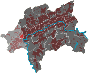
Industriestraße (district)
|
Industriestrasse (35) Quarter of Wuppertal |
|
|---|---|
| Coordinates | 51 ° 14 '37 " N , 7 ° 5' 14" E |
| height | 180 m above sea level NHN |
| surface | 0.70 km² |
| Residents | 192 (December 31, 2014) |
| Population density | 274 inhabitants / km² |
| Proportion of foreigners | 10.9% (Dec. 31, 2014) |
| Post Code | 42327 |
| prefix | 0202 |
| Upper level | Vohwinkel |
| Transport links | |
| bus | 629 AST29 |
| Source: Wuppertal statistics - spatial data | |
The Wuppertal residential area Industriestraße is one of nine quarters in the Vohwinkel district . It is named after the central thoroughfare of the same name.
geography
The 0.7 km² residential area is bordered by the federal motorway 535 in the east, by the Wuppertaler Nordbahn in the north, by the Düsseldorf – Elberfeld railway line in the south and by a connecting curve between the two railway lines in the west.
The residential area has only a small amount of residential development, but is almost entirely built up with commercial settlements under the names of the Sonnborn industrial area and the Möbeck industrial area .
The spherical gas tank built in 1958 is striking for the industrial area .
The street "Industriestraße"
Industriestraße is the extension of Möbecker Straße and begins in the south at the confluence with Heinrich-Heine-Straße and leads north along the Sonnborner Kreuz . The road turns in a wide arc to the west and after around 900 meters it creates a connection to the east via the German ring to the Varresbeck district. After about 1000 meters, a connection leads over the Heuweg (through a tunnel below the railway line) to the Lüntenbeck residential area. Shortly afterwards, the Essener Strasse , coming from the south, runs through the middle of the industrial park. Industriestrasse, which continues to curve in a wide arc, ends after around 1400 meters at a turning point. The street was named on December 14, 1920.
Individual evidence
- ^ Wolfgang Stock: Wuppertal street names. Thales Verlag, Essen-Werden 2002, ISBN 3-88908-481-8 .


