Herbringhausen (district)
|
Herbringhausen (88) District of Wuppertal |
|
|---|---|
| Coordinates | 51 ° 14 '23 " N , 7 ° 15' 48" E |
| height | 331 m above sea level NHN |
| surface | 16.91 km² |
| Residents | 2149 (December 31, 2016) |
| Population density | 127 inhabitants / km² |
| Proportion of foreigners | 3.9% (Dec. 31, 2016) |
| Incorporation | 1929 |
| Post Code | 42399 |
| prefix | 0202 |
| Borough | Langerfeld-Beyenburg |
| Transport links | |
| bus | 669 NE8 |
| Source: Wuppertal statistics - spatial data | |
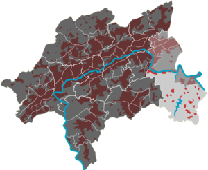
The Herbringhausen residential area in Wuppertal is one of nine districts in the Langerfeld-Beyenburg district . It is named after the centrally located hamlet of Herbringhausen and is the largest residential area in Wuppertal.
geography
The 16.91 km² residential area includes the eponymous hamlet of Herbringhausen, the rural suburbs, residential areas and farms of Cluse , Frielinghausen , Gangolfsberg , Grünental , Hardtbacher Höhe , Hardtplätze , Hastberg , Hastberger Mühle , Hinter der Cluse , In der Hardt , In der Heye , Laaken , Laaker Hammer , Kotthausen , Luckhauser Kotten , Mesenholl , Niedersondern , Nöllenberg , Obersondern , Olpe , Rottland , Sieperhof , Spieckern , Spieckerheide , Spieckerlinde , Stoffelsberg , Trumpet , Walbrecken , Wefelpütt , Windfoche and Windgassen .
It borders in the north on the residential quarters Beyenburg-Mitte and Ehrenberg , in the west on Hammesberg and Erbschlö-Linde , in the south on Remscheid - Lüttringhausen and in the east on the city of Radevormwald .
The most important bodies of water are the Marscheider Bach , the Herbringhauser Bach (both with the Wupper as receiving water ) and the Herbringhauser Dam . Other Wupper tributaries in the residential area are Wilhelmstaler Bach with the inflow Frielingshausener Bach , Hardtbach , Lohbach , Nöllenberger Bach , Stoffelsberger Bach , Hofsiefen , Hengstener Bach , Steinhauser Bach , Lohmühlenbach and Eschensiepen .
The quarter is largely wooded. From east to west there are the forest areas of Marscheider Wald , Herbringhauser Wald , parts of the Sondernbusch and the Garschager Heide .
history
In the late Middle Ages and early modern times, the Herbringhausen area belonged to the parish of Lüttringhausen in the Bergisch Amt of Beyenburg and covered most of the Walbrecken and Garschagen honors . With the transition to Prussia after the French occupation in 1813, the area was assigned to the municipality of Lüttringhausen in the Lennep district . In 1929 it was incorporated into the newly founded city of Wuppertal together with Beyenburg.


