
District of Koblenz
| coat of arms | Germany map | |
|---|---|---|

|
Coordinates: 50 ° 21 ' N , 7 ° 36' E |
|
| Basic data (as of 1970) | ||
| Existing period: | 1816-1970 | |
| State : | Rhineland-Palatinate | |
| Administrative region : | Koblenz | |
| Administrative headquarters : | Koblenz | |
| Area : | 334.79 km 2 | |
| Residents: | 97,226 (Jun 30, 1969) | |
| Population density : | 290 inhabitants per km 2 | |
| License plate : | KO | |
| Circle key : | 07 1 36 | |
| Circle structure: | 41 municipalities | |
| Location of the Koblenz district in Rhineland-Palatinate | ||
  |
||


The district of Koblenz is a former district in Rhineland-Palatinate . Today his area belongs to the Mayen-Koblenz district . The district seat was in Koblenz .
geography
Neighboring areas
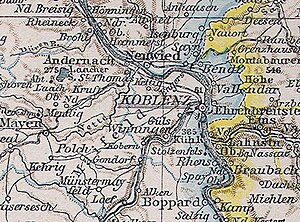
At the beginning of 1969, the district bordered clockwise in the north, beginning with the district of Neuwied and the Unterwesterwaldkreis , the independent city of Koblenz as well as the Loreley district and the districts of Sankt Goar and Mayen .
history
Koblenz district
In 1815 the Rhineland was assigned to the Kingdom of Prussia at the Congress of Vienna . 1815, 1822 in which it was under the Prussian administration Rhine Province risen Grand Duchy of the Lower Rhine formed in 1816 and this in turn in circles in mayors were divided. The "District of Coblenz" was initially divided into the mayorships of Koblenz , Bassenheim , Bendorf , Ehrenbreitstein , Engers , Rhens , St. Sebastian , Vallendar and Winningen . In 1822 the mayor's office in Engers was assigned to the Neuwied district .
District of Koblenz
In 1887 the city of Koblenz left the district and became a district. At the same time the name was county in the district changed. In the period that followed, several municipalities in the district were incorporated into Koblenz: Neuendorf in 1891 , Moselweiß in 1902 , Wallersheim in 1923 and Ehrenbreitstein , Horchheim , Metternich , Neudorf , Niederberg and Pfaffendorf in 1937 .
In 1926 the official spelling was changed to the Koblenz district . Since 1946 the district has been part of the newly founded state of Rhineland-Palatinate .
As part of the first stage of the Rhineland-Palatinate district reform on June 7, 1969, the communities of Alken , Beulich , Brey , Brodenbach , Burgen , Dommershausen , Eveshausen , Macken , Morshausen , Niederfell , Nörtershausen , Oberfell and Spay became part of the dissolved district of St. Goar as well as the communities of Gondorf , Hatzenport , Kattenes , Lehmen and Löf from the Mayen district are incorporated into the Koblenz district. At the same time, the communities of Kapellen-Stolzenfels and Kesselheim left the district and were incorporated into Koblenz.
The district was dissolved on November 7, 1970:
- The communities of Beulich, Dommershausen, Eveshausen and Morshausen came to the Rhein-Hunsrück district .
- The communities Arenberg-Immendorf , Arzheim , Bubenheim , Güls , Lay and Rübenach were incorporated into Koblenz.
- All other municipalities together with most of the dissolved Mayen district formed the new Mayen-Koblenz district .
Population development
| Residents | 1816 | 1871 | 1885 | 1900 | 1910 | 1925 | 1939 | 1950 | 1960 | 1969 |
|---|---|---|---|---|---|---|---|---|---|---|
| 39,698 | 46.054 | 54,755 | 60,563 | 63,619 | 68,457 | 58,029 | 67,227 | 74,900 | 98,000 |
District administrators
- 1816–1828 Carl Joseph Burret
- 1828–1829 Jacob Reiff (substitute)
- 1829–1830 Jakob d'Ester (substitute)
- 1830–1857 Klemens von Boos-Waldeck
- 1857 Ferdinand von Bleul (by order)
- 1857–1859 Reinhard von Hymmen
- 1859 Oskar von Nostitz (by order)
- 1859 Gustav Blancke (by order)
- 1859–1884 Jakob Raitz von Frentz
- 1884–1889 Otto Graf Beissel von Gymnich
- 1889–1896 Franz von Brühl
- 1896–1918 Franz von Barton called von Stedmann
- 1919–1921 Sigmund Adelmann von Adelmannsfelden
- 1922–1933 Gerhard Weil
- 1933–1940 Wilhelm Struve
- 1940–1942 Karl Statz (substitute)
- 1942–1945 Hans Ballmaier (acting)
- 1945–1947 Maximilian Raitz von Frentz
- 1947–1960 Jakob Jost
- 1961– Karl Rittel
cities and communes
The following table contains all cities and municipalities that belonged to the district before 1969 as well as all incorporations:
| local community | incorporated after | Date of incorporation |
|---|---|---|
| Arenberg | Arenberg-Immendorf | 7th June 1969 |
| Arzheim | Koblenz | November 7, 1970 |
| Bassenheim | ||
| Bendorf , city | ||
| Bisholder | Guls | April 1, 1938 |
| Bubenheim | Koblenz | November 7, 1970 |
| Thieving | ||
| Ehrenbreitstein | Koblenz | July 1, 1937 |
| Guls | Koblenz | November 7, 1970 |
| Horchheim | Koblenz | July 1, 1937 |
| Immendorf | Arenberg-Immendorf | 7th June 1969 |
| Kaltenengers | ||
| Kapellen-Stolzenfels | Koblenz | 7th June 1969 |
| Careless | Mülheim-Kärlich | 7th June 1969 |
| Kesselheim | Koblenz | 7th June 1969 |
| Chained | ||
| Kobern | Kobern-Gondorf | 7th June 1969 |
| Lay | Koblenz | November 7, 1970 |
| Mallendar | Vallendar | April 1, 1939 |
| Metternich | Koblenz | July 1, 1937 |
| Moselle white | Koblenz | April 1, 1902 |
| Mülheim | Mülheim-Kärlich | 7th June 1969 |
| Neudorf | Koblenz | July 1, 1937 |
| Neuendorf | Koblenz | July 1, 1891 |
| Niederberg | Koblenz | July 1, 1937 |
| Niederwerth | ||
| Pfaffendorf | Koblenz | July 1, 1937 |
| Rhens | ||
| Rübenach | Koblenz | November 7, 1970 |
| Saint Sebastian | ||
| Sayn | Bendorf | October 1, 1928 |
| Arable | ||
| Urmitz | ||
| Vallendar , city | ||
| Waldesch | ||
| Wallersheim | Koblenz | October 1, 1923 |
| Weißenthurm | ||
| Weitersburg | ||
| Winningen | ||
| Clouds |
The municipalities of Alken , Arenberg-Immendorf , Beulich , Brey , Brodenbach , Burgen , Dommershausen , Eveshausen , Hatzenport , Kattenes , Kobern-Gondorf , Lehmen , Löf , Macken , Morshausen , Mülheim-Kärlich , Niederfell , Nörtershausen , Oberfell and Spay belonged to the district only in the last year of its existence between June 7, 1969 and November 7, 1970.
License Plate
On July 1, 1956, the district was assigned the distinctive sign KO when the vehicle registration number that is still valid today was introduced . It is issued in the independent city of Koblenz until today.
Web links
Individual evidence
- ↑ Rhineland-Palatinate, digitization portal Dilibri: The Government District Coblenz after its location, Begränzung, size, population and classification. Pauli, Coblenz 1817, p. IX.
- ^ Rolf Jehke: Territorial changes in Germany: District of Koblenz. Retrieved May 22, 2009 .
- ^ Federal Statistical Office (ed.): Historical municipality directory for the Federal Republic of Germany. Name, border and key number changes in municipalities, counties and administrative districts from May 27, 1970 to December 31, 1982 . W. Kohlhammer, Stuttgart / Mainz 1983, ISBN 3-17-003263-1 , p. 421 .
- ↑ Official municipality directory (= State Statistical Office of Rhineland-Palatinate [Hrsg.]: Statistical volumes . Volume 407 ). Bad Ems February 2016, p. 152 (PDF; 2.8 MB).
- ^ Contributions to the statistics of the Königl. Prussian Rhineland. 1829, p. 20 , accessed November 11, 2017 .
- ^ Community encyclopedia for the Kingdom of Prussia 1885
- ^ A b Michael Rademacher: German administrative history from the unification of the empire in 1871 to the reunification in 1990. rhp_koblenz.html # landkreis. (Online material for the dissertation, Osnabrück 2006).
- ^ Horst Romeyk : The leading state and municipal administrative officials of the Rhine Province 1816–1945 (= publications of the Society for Rhenish History . Volume 69 ). Droste, Düsseldorf 1994, ISBN 3-7700-7585-4 , p. 283-284 .
- ^ Municipal directory 1910: District of Koblenz .
1969: Alzey district | District of Bergzabern | District of Bernkastel | District of Bingen | District of Cochem | District of Frankenthal (Palatinate) | District of Kirchheimbolanden | Landau district in the Palatinate | Loreley Circle | District of Ludwigshafen am Rhein | District of Mainz | District Neustadt an der Weinstrasse | Rockenhausen district | District of Saarburg | District of Sankt Goar | District of Simmern | District of Speyer | District of Trier | Unterlahnkreis | District of Wittlich | District of Worms | District of Zell (Mosel) . 1970: Bitburg district | District of Koblenz | Mayen County | County of Prüm . 1972: District of Zweibrücken . 1974: Oberwesterwaldkreis | Unterwesterwaldkreis .