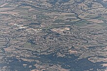
Marsciano
| Marsciano | ||
|---|---|---|

|
|
|
| Country | Italy | |
| region | Umbria | |
| province | Perugia (PG) | |
| Coordinates | 42 ° 55 ' N , 12 ° 20' E | |
| height | 184 m slm | |
| surface | 161.5 km² | |
| Residents | 18,503 (Dec. 31, 2019) | |
| Population density | 115 inhabitants / km² | |
| Post Code | 06055 | |
| prefix | 075 | |
| ISTAT number | 054027 | |
| Popular name | Marscianesi | |
| Patron saint | San Giovanni Battista (June 24th) | |
| Website | Marsciano | |
Marsciano is a municipality in the Italian province of Perugia in the Umbria region with 18,503 inhabitants (as of December 31, 2019).
geography
The city is located about 25 km south of Perugia and covers an area of 161.5 km². The place is on the Nestore River .
The districts include Badiola, Castello delle Forme, Castiglione della Valle , Cerqueto, Compignano, Mercatello, Migliano, Montelagello, Morcella, Monte Vibiano Vecchio, Olmeto, Papiano, Pieve Caina, San Biagio della Valle, San Valentino della Collina, Sant'Apollinare , Sant'Elena, Spina and Villanova.
The neighboring municipalities are Collazzone , Deruta , Fratta Todina , Perugia , Piegaro , San Venanzo ( TR ) and Todi .
Twin cities
sons and daughters of the town
- Mario Ceccobelli (* 1941), Catholic clergyman, Bishop of Gubbio
- Giancarlo Antognoni (* 1954), football player
Web links
Commons : Marsciano - collection of images, videos and audio files
Individual evidence
- ↑ Statistiche demografiche ISTAT. Monthly population statistics of the Istituto Nazionale di Statistica , as of December 31 of 2019.


