
Ranstadt
| coat of arms | Germany map | |
|---|---|---|

|
Coordinates: 50 ° 21 ' N , 8 ° 59' E |
|
| Basic data | ||
| State : | Hesse | |
| Administrative region : | Darmstadt | |
| County : | Wetteraukreis | |
| Height : | 131 m above sea level NHN | |
| Area : | 34.26 km 2 | |
| Residents: | 5099 (Dec. 31, 2019) | |
| Population density : | 149 inhabitants per km 2 | |
| Postal code : | 63691 | |
| Primaries : | 06041, 06035 , 06046 | |
| License plate : | FB, BÜD | |
| Community key : | 06 4 40 020 | |
| LOCODE : | DE RAX | |
| Community structure: | 5 districts | |
| Address of the municipal administration: |
Main street 15 63691 Ranstadt |
|
| Website : | ||
| Mayoress : | Cäcilia Reichert Dietzel ( SPD ) | |
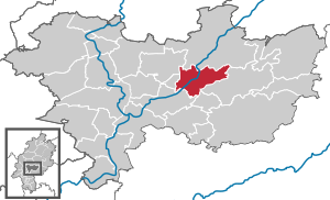
| Location of the community Ranstadt in the Wetterau district | ||
  |
||

Ranstadt is a municipality in the Wetterau district in Hesse .


geography
Ranstadt lies at an altitude of 134 m above sea level . It is a small center in the middle of the Wetteraukreis, at the transition from the Wetterau to the Vogelsberg . The next larger cities are (clockwise, starting in the west) Friedberg (Hessen) (17 km), Bad Nauheim (20 km), Nidda (six kilometers) and Büdingen (15 km). Other important surrounding cities are Frankfurt am Main , Hanau and Gießen . In particular, Frankfurt with the Frankfurt / Rhein-Main airport (approx. 40 minutes by car) plays an important role for commuters and travelers.
Neighboring communities
Ranstadt borders the city of Nidda in the north, the city of Ortenberg in the east, the community of Glauburg in the southeast, the city of Florstadt in the south and the city of Reichelsheim and the community of Echzell in the west .
Community structure
The districts of Bellmuth , Bobenhausen I , Dauernheim , Ober-Mockstadt and Ranstadt are rural communities in the Nidda and Laisbachtal .
history
middle Ages
The oldest surviving mention of Ranstadt can be found as Ramstat in a document of the Fulda monastery , which was created between the years 750 and 802. In the Middle Ages and in the early modern period, Ranstadt belonged to the Ortenberg Office , a condominium that was formed by three rulers from among the members of the Wetterau Counts' Association .
Ecclesiastically Ranstadt belonged to the collegiate monastery Mockstadt in the Archdiocese of Mainz . The central church authority was the Archdiaconate of St. Maria ad Gradus in Mainz .
Early modern age
Since all three gentlemen of the condominate turned to the Reformation , Ranstadt also became Lutheran . In 1556 it was given its own parish. In 1601 there was a real division of the condominium, with Ranstadt being added to the rule Gedern of the Counts of Stolberg-Gedern . Ranstadt is one of the areas in which the Solms land law of 1571 was accepted under customary law , but only partially . This applied in particular to the areas of guardianship law , inheritance and matrimonial property law . Moreover, the applied Common Law . It was not until January 1, 1900, when the Civil Code , which was uniformly valid throughout the German Reich , that the old particular law was suspended .
Modern times
In 1806 the County of Stolberg - and with it Ranstadt - fell to the Grand Duchy of Hesse . Here Ranstadt belonged to the civil office of Gedern. In 1821 the Grand Duchy formed the district of Nidda , to which Ranstadt was also assigned, and which was called Kreis Nidda from 1832 . With the revolution of 1848 the administrative district of Nidda was briefly formed, but in 1852 the district of Nidda was revived. In 1874 the village became part of the Büdingen district .
Incorporations
On the occasion of the regional reform in Hesse on October 1, 1971, the communities of Bellmuth, Bobenhausen I, Dauernheim and Ober-Mockstadt were incorporated into the community of Ranstadt.
Population development
- 1939: 671 inhabitants
- 1961: 1225 inhabitants
- 1970: 1516 inhabitants
- 2010: 4894 inhabitants
- 2011: 4933 inhabitants
- 2015: 5077 inhabitants
politics
Community representation
The local elections on March 6, 2016 produced the following results, compared to previous local elections:
| Parties and constituencies |
% 2016 |
Seats 2016 |
% 2011 |
Seats 2011 |
% 2006 |
Seats 2006 |
% 2001 |
Seats 2001 |
||
|---|---|---|---|---|---|---|---|---|---|---|
| SPD | Social Democratic Party of Germany | 39.8 | 9 | 49.6 | 12 | 37.4 | 12 | 39.3 | 12 | |
| CDU | Christian Democratic Union of Germany | 32.2 | 7th | 26.1 | 6th | 29.7 | 9 | 25.9 | 8th | |
| FWG | Free community of voters Ranstadt | 20.6 | 5 | 14.4 | 3 | 27.2 | 8th | 27.5 | 9 | |
| GREEN | Alliance 90 / The Greens | 7.4 | 2 | 9.8 | 2 | 5.7 | 2 | 7.4 | 2 | |
| total | 100.0 | 23 | 100.0 | 23 | 100.0 | 31 | 100.0 | 31 | ||
| Voter turnout in% | 54.0 | 52.9 | 51.8 | 57.7 | ||||||
mayor
Cäcilia Reichert-Dietzel has been the mayor of Ranstadt since 2009. The past mayoral elections produced the following results:
|
||||||||||||||||||||||||||||||
coat of arms
The coat of arms was approved on June 12, 1982 by the Hessian Ministry of the Interior.
Blazon : "A black, striding deer in a shield divided into nine red and silver."
The now created coat of arms takes into account the historical past of the new parts of the municipality. The black stag comes from the coat of arms of the Counts of Stolberg, who originally owned Ranstadt. This stag was already used in the old Ranstädter coat of arms. The red and white stripes, which replace the golden background of the Stolberg coat of arms, indicate the local rulers of the Landgraves of Hesse and the Counts of Isenburg that predominate in the other parts of the municipality.
The coat of arms was designed by heraldist Heinz Ritt .
Transport and infrastructure
Ranstadt has a stop on the Gießen – Gelnhausen railway line , on which regional trains run by the Hessian state railway run almost every hour . In addition to the train service, there is line 374, which provides another connection on the route Nidda - Büdingen - Gelnhausen in the morning and in the evening.
At Ranstadt train station, there are bus connections, usually hourly, to Friedberg (FB-03), Nidda (FB-81, FB-82) and Ortenberg (FB-03), which also connect all districts to the bus network.
Culture and sights
Buildings
- Neo-Gothic town hall (1875)
- Stolbergisches Hofgut, today: SV Ranstadt's sports home
nature
societies
- Nature and bird protection group Ranstadt
Sons and daughters of the church
- Heinrich Jung (born December 6, 1892, Gedern) came to Ranstadt when he was two years old, where his family had lived since 1498; Pharmacist, chemist, researched cancer and malaria , author (e.g .: "Hessespichel")
- Peter Brunner (born April 25, 1900, Arheiligen , † May 24, 1981 in Heidelberg ), clergyman and systematic theologian . From 1932 to 1936 pastor in Ranstadt and imprisoned for 4 months in Dachau concentration camp in 1935 .
- Henning Goll (* 1965, Ranstadt). Active in the national team for disabled swimmers in 1989 and 1990, and during this time he won the 1901 e. V. eight gold medals as well as several silver and bronze medals at international and German championships, whereby he swam two new German records at the same time.
literature
- Hans Georg Ruppel (edit.): Historical place directory for the area of the former Grand Duchy and People's State of Hesse with evidence of district and court affiliation from 1820 until the changes in the course of the municipal regional reform = Darmstädter Archivschriften 2. 1976, p. 174.
- Heinz Wionski: Monument topography Federal Republic of Germany. Cultural monuments in Hessen. Wetteraukreis I. Stuttgart 1999, pp. 420-429.
Web links
- Website of the municipality of Ranstadt
- "Ranstadt, Wetteraukreis". Historical local dictionary for Hessen. In: Landesgeschichtliches Informationssystem Hessen (LAGIS).
- Literature about Ranstadt in the Hessian Bibliography
- Literature by and about Ranstadt in the catalog of the German National Library
- Link catalog on Ranstadt at curlie.org (formerly DMOZ )
Individual evidence
- ↑ Hessian State Statistical Office: Population status on December 31, 2019 (districts and urban districts as well as municipalities, population figures based on the 2011 census) ( help ).
- ↑ Arthur Benno Schmidt : The historical foundations of civil law in the Grand Duchy of Hesse . Curt von Münchow, Giessen 1893, p. 108, note 36 and p. 25, note 81, as well as the enclosed map.
- ^ Federal Statistical Office (ed.): Historical municipality directory for the Federal Republic of Germany. Name, border and key number changes in municipalities, counties and administrative districts from May 27, 1970 to December 31, 1982 . W. Kohlhammer GmbH, Stuttgart / Mainz 1983, ISBN 3-17-003263-1 , p. 352 .
- ^ Result of the municipal election on March 6, 2016. Hessian State Statistical Office, accessed in April 2016 .
- ^ Hessian State Statistical Office: Result of the municipal elections on March 27, 2011
- ^ Hessian State Statistical Office: Result of the municipal elections on March 26, 2006
- ↑ State Gazette for the State of Hesse 1982 Official Gazette No. 27 page 1228 ( Memento of the original from November 1, 2013 in the Internet Archive ) Info: The archive link has been inserted automatically and has not yet been checked. Please check the original and archive link according to the instructions and then remove this notice.
- ↑ His church fight was recorded by "Otto Bruder" (pseudonym of Otto Salomon ): The village on the mountain .

Altenstadt | Bad Nauheim | Bad Vilbel | Büdingen | Butzbach | Echzell | Florstadt | Friedberg (Hesse) | Gedern | Glauburg | Hirzenhain | Karben | Kefenrod | Limeshain | Munzenberg | Nidda | Niddatal | Ober-Mörlen | Ortenberg | Ranstadt | Reichelsheim (Wetterau) | Rockenberg | Rosbach v. d. Height | Wölfersheim | Wöllstadt