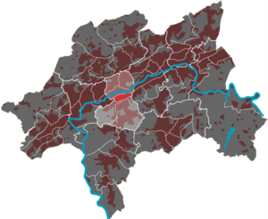
Südstadt (Wuppertal Quarter)
|
Südstadt (03) district of Wuppertal |
|
|---|---|
| Coordinates | 51 ° 15 '7 " N , 7 ° 8' 59" E |
| height | 150– 185 m above sea level NHN |
| surface | 0.59 km² |
| Residents | 10,047 (Dec. 31, 2016) |
| Population density | 17,029 inhabitants / km² |
| Proportion of foreigners | 25.0% (Dec. 31, 2016) |
| Post Code | 42119 |
| prefix | 0202 |
| Borough | Elberfeld |
| Transport links | |
| railroad |
RB 48 RE 4 RE 7 RE 13 |
| Train | S 7 S 8 S 9 |
| bus | 603 607 613 615 619 620 625 635 645 NE6 NE7 |
| Source: Wuppertal statistics - spatial data | |
The Südstadt residential area in Wuppertal is one of six districts in the Elberfeld district .
geography
The 0.59 km² residential area is in the north by the Düsseldorf – Elberfeld railway and its eastern continuation, the Elberfeld – Dortmund railway , in the east by the street Klophaus , in the south by the streets Ronsdorfer Straße , Blankstraße and Südstraße and in the west by the South road limited. Clockwise, the residential areas Elberfeld-Mitte , Hesselnberg , Grifflenberg , Friedrichsberg and Arrenberg surround the Südstadt residential area. The residential area is mainly on the Döppersberg elevation .
With the exception of the eastern tip, the residential area is almost entirely built up with residential developments and is part of the Elberfeld city center. The platforms of the Wuppertal main station are on the northern edge in the residential area. The Christ Church and the Church of St. Suitbertus are among the outstanding buildings . The residential area has a primary school.
During the air raids on Wuppertal , the historic buildings in the southern part of the city were almost completely destroyed. Today, post-war new buildings predominate.

