
Sülzetal
| coat of arms | Germany map | |
|---|---|---|

|
Coordinates: 52 ° 1 ' N , 11 ° 32' E |
|
| Basic data | ||
| State : | Saxony-Anhalt | |
| County : | Börde | |
| Height : | 94 m above sea level NHN | |
| Area : | 103.71 km 2 | |
| Residents: | 8851 (Dec. 31, 2019) | |
| Population density : | 85 inhabitants per km 2 | |
| Postal code : | 39171 | |
| Primaries : | 039205 (district Dodendorf 0391) | |
| License plate : | BK , BÖ, HDL, OC, OK, WMS, WZL | |
| Community key : | 15 0 83 490 | |
| LOCODE : | DE ULZ | |
| Community structure: | 8 districts | |
| Address of the municipal administration: |
Old village street 26 39171 Sülzetal, Osterweddingen district |
|
| Website : | ||
| Mayor : | Jörg Methner | |
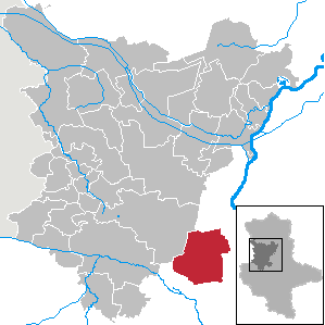
| Location of the municipality of Sülzetal in the Börde district | ||
  |
||

Sülzetal is a unified municipality in the Börde district in Saxony-Anhalt .
geography
The municipality of Sülzetal is located in the middle of the fertile Magdeburg Börde and is directly connected to the area of the state capital Magdeburg. The mostly flat, undulating, forestless landscape reaches heights of just over 100 m above sea level. NN ( Heßberg 103 m). In the district of Sülldorf, the source brooks of the small river Sülze , which flows a few kilometers away into the Elbe , come together.
Neighboring communities
The following municipalities border Sülzetal (clockwise, starting from the north): Magdeburg , Welsleben , Biere , Borne , Unseburg , Wolmirsleben , Egeln , Etgersleben , Bottmersdorf and Wanzleben-Börde .
Community structure
|
The following districts are identified: |
The following are designated as living spaces in the municipality:
|
history
The still young community was formed on April 1, 2001 from the previously independent communities Altenweddingen, Bahrendorf, Dodendorf, Langenweddingen, Osterweddingen, Schwaneberg and Sülldorf. These communities were previously members of the Sülzetal administrative community of the same name. The eighth member community, Beyendorf, did not go along with this step towards a unified community, but was incorporated into the state capital Magdeburg by referendum.
The current districts of Sülldorf and Osterweddingen were first mentioned in documents in 937. The first lignite was mined in Prussia in 1768 in Altenweddingen .
The protected cultural monuments of the municipality are listed in the local register of monuments.
politics

Municipal council
The council consists of 20 council members and the mayor. In the local election on May 26, 2019 , the following distribution of seats in the local council resulted:
| List: | CDU | SPD | left | FDP | AfD | KHV / OSV * | WVU ** | EB | total |
|---|---|---|---|---|---|---|---|---|---|
| 2014: | 8 seats | 6 seats | 3 seats | 1 seat | - | 2 seats | - | - | 20 seats |
| 2019: | 6 seats | 4 seats | 2 seat | 1 seat | 4 seats | 1 seat | 1 seat | 1 seat | 20 seats |
* Culture and sport Osterweddingen ** Voters' association of independent citizens Dodendorf
mayor
In May 2001 Erich Wasserthal (SPD) was elected mayor. He was re-elected in 2008, Jörg Methner lost. In October 2013 Jörg Methner (SPD) was elected as the new mayor.
coat of arms
The coat of arms was approved by the district on October 18, 2005. It was designed by the Magdeburg graphic artist Rudolf Pötzsch.
Blazon : “Goepel cut in red, green and silver, on the right a cogwheel half covered by a pointed, winged Mercury stick placed at an angle, all in gold; on the left three ears of corn in gold; three-flowered salt aster standing vertically above wavy beams in blue with two stem leaves in green, with golden insets, petals in blue. "
Economy and Infrastructure
Transport links
The federal motorway 14 (Magdeburg - Leipzig - Dresden ) with the junctions Magdeburg-Sudenburg and Reform runs along the north-eastern edge of the municipality . The federal highways 81 (partly four-lane), 71 and 246a also run through the municipality. The places in the municipality of Sülzetal are served by bus lines from PNVG Staßfurt, KVG BÖRDE-BUS, Oschersleben, and Schönebecker Buslinien GmbH.
The Dodendorf station and the stops in Osterweddingen and Langenweddingen are on the Magdeburg – Thale railway line . While the regional trains serve all three stations, the regional express trains only stop in Osterweddingen. There is a "train-bus interface", where there is a connection to buses to the industrial park as well as to Altenweddingen, Bahrendorf and Schwaneberg. These places were previously opened up by the Schönebeck – Blumenberg railway line , which was closed on December 31, 1999.
The community's cultural monuments are listed in the local register of monuments.
Web links
Individual evidence
- ↑ State Statistical Office Saxony-Anhalt, population of the municipalities - as of December 31, 2019 (PDF) (update) ( help ).
- ↑ a b StBA: Area changes from 01.01. until December 31, 2001
- ↑ Municipality of Sülzetal - Announcement of the final election results ... of the municipal council election on May 26, 2019 , accessed on November 1, 2019
- ↑ http://www.stala.sachsen-anhalt.de/wahlen/bmbm/index.html
- ↑ New interface at Osterweddingen train station offers short distances between train and bus. Nahverkehrsservice Sachsen-Anhalt GmbH, December 12, 2019, accessed on February 6, 2020 .