
St. Lorenz (Upper Austria)
|
St. Lorenz
|
||
|---|---|---|
| coat of arms | Austria map | |
 |
|
|
| Basic data | ||
| Country: | Austria | |
| State : | Upper Austria | |
| Political District : | Vöcklabruck | |
| License plate : | VB | |
| Surface: | 23.56 km² | |
| Coordinates : | 47 ° 49 ' N , 13 ° 21' E | |
| Height : | 490 m above sea level A. | |
| Residents : | 2,519 (Jan 1, 2020) | |
| Postal code : | 5310 | |
| Area code : | 06232 | |
| Community code : | 4 17 35 | |
| NUTS region | AT315 | |
| Address of the municipal administration: |
Wredeplatz 2 5310 Mondsee |
|
| Website: | ||
| politics | ||
| Mayor : | Andreas Hammerl ( ÖVP ) | |
|
Municipal Council : (2015) (25 members) |
||
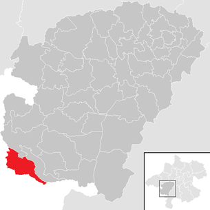
| Location of St. Lorenz in the Vöcklabruck district | ||
  |
||
| Source: Municipal data from Statistics Austria | ||


St. Lorenz is a municipality in Upper Austria in the Vöcklabruck district in the Hausruckviertel with 2519 inhabitants (as of January 1, 2020). The community belonged to the judicial district Mondsee until July 1, 2013 , since then to the judicial district Vöcklabruck .
geography
St. Lorenz is 490 m above sea level in the Hausruckviertel. The extension is 8.5 km from north to south and 7.7 km from west to east. The total area is 23.4 km², 38.5% of the area is forested and 52.1% of the area is used for agriculture.
Community structure
The municipality includes the following localities (population in brackets as of January 1, 2020):
- Chaste (896)
- Sharpling (60)
- St. Lorenz (1563)
Other districts of the community are Gries, Plomberg, Black India and Wagnermühle.
history
In Scharfling and Mooswinkel, the first pile dwellings of the Mondsee culture from the late Neolithic period were built in the period from 3600 to 3300 BC in the 19th century . Found. The Scharfling wooden object was recovered by J. Offenberger from the Scharfling riverside settlement, which was measured in 1972. According to the C14 dating of piles, the settlement dates from the final phase of ribbon ceramics in the Neolithic. (Data from Offenberger 1981): VRI 311: BP 4980 ± 120 VRI 313: BP 4660 ± 90.
Originally located in the eastern part of the Duchy of Bavaria, the place belonged to the Duchy of Austria since the 12th century . Since 1490 it has been assigned to the Principality of Austria ob der Enns . During the Napoleonic Wars , the place was occupied several times by Bavaria.
The place name Black India is unusual . Several legends are circulating about its creation. According to the memories of the later photographer Bruno Reiffenstein , the name was given as follows: A group of young students who called themselves the “Mondsee Brotherhood” and to which he and his brother, the later well-known genre painter Leo Reiffenstein belonged, “discovered” the previously undeveloped shoreline and gave it the name "Black India" in a romantic action on August 11, 1879. The Mondsee businessman Eduard Weyringer bought the area, took over the prominent name and set up the snack bar "Black India" (with a hyphen). From 1890–1893, the Salzkammergut local railway was built in several stages , and thanks to Weyringer's initiative, it received the “Black India” stop (now in one word). After the First World War, villas were built on the bank. In 1957 the local railway was shut down, the station disappeared, but the name Black India has remained.
St. Lorenz has belonged to the federal state of Upper Austria since 1918. After the annexation of Austria to the German Reich on March 13, 1938, the place belonged to the Gau Oberdonau . In 1945 Upper Austria was restored.
Population development
In 1991 the municipality had 1,822 inhabitants according to the census, in 2001 it had 2,010 inhabitants.
The population then continued to rise relatively sharply and amounted to 2,113 in 2006 and 2,430 in 2016. Today (as of January 1, 2020) there are 2519 inhabitants.
Culture and sights
- The St. Lorenz branch church ( location ) was the only object of the St. Lorenz community to be protected by the Federal Monuments Office. The single-nave baroque building with a double tower facade and a cross-shaped floor plan was built between 1726 and 1730.
- The Wistaudermühle ( location ) with a chapel next to it is a monument to rural culture in the Salzkammergut. The mill with overshot water wheel was built in 1856 by Jakob Wesenauer, the owner of the Wistauderhof at the time, and was in operation until the 1970s. The mill has been open to the public since the renovation in 2003–2004.
- Kulturgut Höribach (art gallery and music events)
tourism
- The Drachenwand is a popular destination. From St. Lorenz a “normal route” (very steep, some ladder stairs and wire rope insurance) and a via ferrata (difficulty C / D) built in 2008 lead to the summit.
- Golf club on the Mondsee
- St. Lorenz bathing complex
Economy and Infrastructure
Public facilities
- In Scharfling is the Institute for Water Ecology, Fisheries and Lake Research belonging to the Federal Office for Water
politics
On January 30, 2018, the previous mayor Johannes Garderer (ÖVP) resigned after receiving a complaint about abuse of office and infidelity in his office. Garderer was mayor of the municipality since 2009. Vice-Mayor Karl Nußbaumer (ÖVP) took over the official business on an interim basis, and Andreas Hammerl (ÖVP) was elected as the new mayor on June 10, 2018.
The three neighboring municipalities of Mondsee - Innerschwand , St. Lorenz and Tiefgraben - have a common municipal office in the "City Hall" on Wredeplatz in Mondsee (similar to a German administrative community ).
coat of arms
Blazon : "Split of gold and red with an erect dragon holding a grate pole in alternating colors."
The community colors are red-yellow-black.
The municipal coat of arms was awarded in 1984. The dragon stands for the dragon wall , at the foot of which is St. Lorenz, and the dragon who, according to legend, should have lived there. The rust as an attribute of St. Lawrence refers to the church patron and namesake of the place.
Personalities
Personalities associated with the community
- Paul Kalisch (1855–1946), German opera singer
- Leo Reiffenstein (1856–1924), genre and landscape painter
literature
- Walter Kunze: Mondsee - Upper Austria. Publishing house St. Peter, Salzburg 1999
Web links
- Map in the Digital Upper Austrian Room Information System ( DORIS )
- 41735 - St. Lorenz (Upper Austria). Community data, Statistics Austria .
- More information about the municipality of St. Lorenz (Upper Austria) on the geographic information system of the state of Upper Austria .
Individual evidence
- ↑ Statistics Austria: Population on January 1st, 2020 by locality (area status on January 1st, 2020) , ( CSV )
- ^ Rudolf Kronenbitter: The Discovery of Black India. In: Schwarz Indien.at. Rudolf Kronenbitter, accessed December 6, 2019 .
- ↑ Federal Office for Water Management
- ↑ nachrichten.at: After a complaint about abuse of office and infidelity, VP-Ortschef resigns
- ^ Ooe.orf.at: New mayor in St. Lorenz
- ↑ Herbert Erich Baumert: The coats of arms of the cities, markets and communities of Upper Austria, 7th supplement (1984–1987) , in Oberösterreichische Heimatblätter, No. 4, 1988, p. 239 f, online (PDF; 7.2 MB) in the forum OoeGeschichte.at

Ampflwang in the Hausruckwald | Attersee am Attersee | Attnang-Puchheim | Atzbach | Aurach am Hongar | Berg im Attergau | Desselbrunn | Fornach | Frankenburg | Frankenmarkt | Gampern | Innerschwand am Mondsee | Lenzing | Manning | Mondsee | Neukirchen an der Vöckla | Niederthalheim | Nussdorf am Attersee | Oberhofen am Irrsee | Oberndorf near Schwanenstadt | Oberwang | Ottnang am Hausruck | Pfaffing | Pilsbach | Pitzenberg | Pondorf | Puchkirchen | Pühret | Redleiten | Redlham | Regau | Riistorf | Rutzenham | Schlatt | Schörfling am Attersee | Schwanenstadt | Seewalchen am Attersee | St. Georgen im Attergau | St. Lorenz | Steinbach am Attersee | Straß im Attergau | Dig deep | Timelkam | Inaccurate | Unterach am Attersee | Vöcklabruck | Vöcklamarkt | Weißenkirchen im Attergau | Weyregg am Attersee | Wolfsegg am Hausruck | Zell am Moos | Zell am Pettenfirst