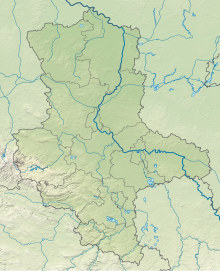
Hose Burgkemnitz
Coordinates: 51 ° 39 ′ 52 " N , 12 ° 22 ′ 47" E
The Burgkemnitz hose is a nature reserve in the municipality of Muldestausee in the Anhalt-Bitterfeld district in Saxony-Anhalt .
description
The nature reserve with the registration number NSG 0163 is around 67 hectares in size. It is congruent with the FFH area of the same name and is surrounded by the "Dübener Heide" conservation area. The area has been under protection since the beginning of 1996 (date of regulation: December 13, 1995). The responsible lower nature conservation authority is the district of Anhalt-Bitterfeld.
The nature reserve is located northeast of Bitterfeld in the Dübener Heide nature park . It provides a north of the depression reservoir lying wetland in the area of former open pit Muldenstein on the edge of Dübener Heide under protection. The post-mining landscape here consists of the remaining open pit waters of the Roter See, the south and west banks of the artificially created, arched Blauer See and a cut in the terrain between two butts made of boulder clay , the "hose". The areas of the nature reserve have been subject to their natural development since 1963.
Along the two lakes in the northeast of the reserve move reed reed beds , large stocks of onion rush in shallow waters and Tonquil dominated plant communities on steep banks and u. a. Lancet-leaved frog spoon on the drain of the Blue Lake. Sand sedge and silver grass settle on sandy areas . In addition, u. a. Sand straw flower , field wormwood , Common Evening Primrose , downy brome , Platthalmrispengras and Country reed grass to find. On areas occupied by poor grass there grow and a. Real sheep fescue , common piglet weed , carnation , mugwort , creeping grouse and ribwort . Ruderal areas are u. a. of Hasenklee , field clover taken and Platthalmrispengras. On the slopes of the Kippen, forest pines and hanging birches are the dominant tree species, as well as bushes with a high proportion of buckthorn . The hems are u. a. formed by zigzag clover , red pea , nodding thistle , meadow marguerite and purées .
In the area of the "tube" and the southern part of the protected area is located between the tilting of one of trenches durchzogenes Ver sumpfungsgebiet , are embedded in the places open water. Reeds made of cattails and reeds as well as stocks of common pond rush dominate here . Along the trenches grow Scheinzypergrassegge , Tonquil , Potamogeton acutifolius , Utricularia vulgaris , Equisetum palustre and Eriophorum angustifolium and Juncus Acutiflorus , Kalmus , Typha angustifolia , Eleocharis palustris and Galium uliginosum .
The nature reserve offers numerous bird species habitat, including bittern , marsh harrier , Little Grebe , Water Rail , Reed Warbler , Whinchat and grasshopper warbler , all also breed here. The nature reserve is also a suitable habitat for amphibians . So live here z. a. Natterjack toad , green toad , common toad , spadefoot , pond frog and marsh frog . Reptiles are z. B. represented by grass snake , smooth snake and sand lizard . The waters and wetlands are also habitat for numerous dragonflies . The beaver is also native to the nature reserve.
The area drains south to the Muldestausee and west to the Green Lake. The nature trail “ Post-Mining Landscape Muldestausee” touches the nature reserve in the south and between the Red and Blue Lakes .
Web links
Individual evidence
- ^ Ulrich Wölfel: On the flora of Bitterfeld and the surrounding area (9th contribution) , communications on floristic mapping in Saxony-Anhalt (Halle 2006) 11: 91–97 (PDF, 353 kB). Retrieved May 16, 2019.
- ^ Muldenstein: NSG hose Burgkemnitz and poplar swamp SW Tiefkippe Schlaitz. (PDF, 631 kB). Retrieved November 26, 2014.
- ↑ Jörg Huth: Occurrence, population and development prognosis of endangered dragonfly species in the lignite mining landscape of Saxony-Anhalt. Retrieved November 26, 2014.
- ^ Hose Burgkemnitz , profiles of the Natura 2000 areas, Federal Agency for Nature Conservation . Retrieved April 18, 2018.
- ↑ Nature trail "Post-Mining Landscape Muldestausee" , Haus am See, Information Center for Environment and Nature Conservation in Schlaitz. Retrieved November 26, 2014.
- ↑ The nature trail ( Memento from December 4, 2014 in the Internet Archive ), Haus am See, Information Center for Environment and Nature Conservation, Schlaitz (JPG, approx. 1.9 MB).


