Semussac
| Semussac | ||
|---|---|---|

|
|
|
| region | Nouvelle-Aquitaine | |
| Department | Charente-Maritime | |
| Arrondissement | Saintes | |
| Canton | Saujon | |
| Community association | Royan Atlantique | |
| Coordinates | 45 ° 36 ′ N , 0 ° 55 ′ W | |
| height | 0-42 m | |
| surface | 24.85 km 2 | |
| Residents | 2,333 (January 1, 2017) | |
| Population density | 94 inhabitants / km 2 | |
| Post Code | 17120 | |
| INSEE code | 17425 | |
| Website | www.semussac.fr | |
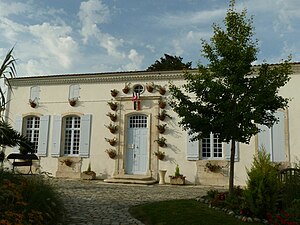
 Semussac town hall |
||
Semussac is a southwestern French municipality with 2333 inhabitants (as of January 1 2017) in the department of Charente-Maritime in the region Nouvelle-Aquitaine (before 2016: Poitou-Charentes ). The municipality belongs to the arrondissement of Saintes and the canton of Saujon (until 2015: canton of Cozes ). The inhabitants are called Semussacais .
geography
Semussac is located about 27 kilometers from Saintes in the old cultural landscape of the Saintonge near the Gironde estuary. Semussac is surrounded by the neighboring communities Le Chay in the north and northeast, Corme-Écluse in the northeast, Grézac in the east, Cozes in the southeast, Arces in the south and southeast, Meschers-sur-Gironde in the southwest, and Saint-Georges-de-Didonne in the west and Médis in the northwest.
Population development
| year | 1962 | 1968 | 1975 | 1982 | 1990 | 1999 | 2006 | 2017 |
| Residents | 863 | 902 | 933 | 1006 | 1208 | 1417 | 1778 | 2333 |
Attractions
- Saint-Etienne church from the 18th century
- Didonne Castle from the 17th century, today an agricultural museum
literature
- Le Patrimoine des Communes de la Charente-Maritime. Flohic Editions, Volume 1, Paris 2002, ISBN 2-84234-129-5 , pp. 235-237.


