Stephens Island (Torres Strait)
| Stephens Island (Ugar) |
||
|---|---|---|
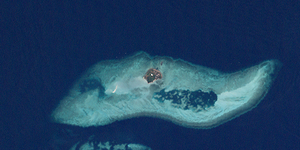
| Landsat image of the island with the much larger surrounding coral reef | ||
| Waters | Pacific Ocean | |
| Archipelago | Torres Strait Islands | |
| Geographical location | 9 ° 30 '27 " S , 143 ° 32' 41" O | |
|
|
||
| length | 900 m | |
| width | 700 m | |
| surface | 37 ha | |
| Highest elevation | 15 m | |
| Residents | 76 (2006) 205 inhabitants / km² |
|
|
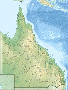
Location of the Torres Strait Islands : Stephens Island (Ugar), center, above. |
||
Stephens Island , called Ugar by the locals , is a small island in the northeast of the Torres Strait Islands . It is located about 185 km northeast of Thursday Island , the "main island" in Torres Strait.
The almost circular, flat overgrown island is of volcanic origin. The highest elevation of the 37 hectare island is only 15 meters above sea level. Stephens Island is surrounded by an 11 km long (west to east) and up to 2.9 km wide and 28 km² large, shallow coral reef, which makes access by water difficult. On the same reef platform about 1400 meters west-southwest of Stephens Island is a small island with no vegetation, with an estimated area of less than 1000 square meters.
There is a small boat dock on the northeast coast and a helicopter landing pad in the center of the island . Stephens Island has a decreasing population. At the 2001 census, 100 people were still living here, five years later only 76.
Administratively, Stephens Island belongs to the Eastern Islands , the easternmost island region in the Torres Shire administrative district of Queensland ( Australia ). The region also includes Murray Island, around 70 km southeast, and Darnley Island, 25 km east . Stephens Island, like neighboring Darnley Island and the uninhabited islands to the east and north of it, is owned by the Meuran tribe, one of the tribes of Murray Island.


