Thursday Islands
| Thursday Islands | ||
|---|---|---|
| Landsat image of the group | ||
| Waters | Pacific Ocean | |
| archipelago | Torres Strait Islands | |
| Geographical location | 10 ° 37 ′ S , 142 ° 13 ′ E | |
|
|
||
| Number of islands | 18th | |
| Main island | Thursday Island | |
| Total land area | 280 km² | |
| Residents | 3500 | |
| Location of the Torres Strait Islands | ||
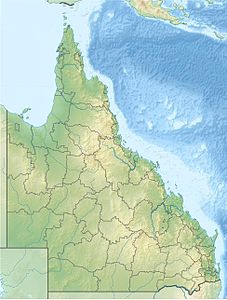
The Thursday Islands , Eng. Thursday Islands are a group of islands belonging to Australia ( Queensland ) in the south of the Torres Strait Islands archipelago . The islands are located a few kilometers off the northwest tip of the Cape York Peninsula in the southwest of the Torres Strait .
In the center of the archipelago lies the main island of the same name, Thursday Island , which forms the administrative center of the Torres Strait Islands. The largest island in the group, however, is the barely populated Prince of Wales Island with an area of 196 km².
Table of the islands
The Thursday Islands include the following islands :
| Island name | Alias | Geocoordinate | surface | population |
|---|---|---|---|---|
| Thursday Island | Wai-Ben | 10 ° 35 ' S , 142 ° 13' E | 3.50 | 2,682 |
| Port Lihou Island | Yeta | 10 ° 44 ′ S , 142 ° 14 ′ E | 3.98 | - |
| Prince of Wales | Murralag | 10 ° 41 ′ S , 142 ° 11 ′ E | 196.3 | 20th |
| Horn Island | Narapui | 10 ° 36 ' S , 142 ° 17' E | 53.16 | 586 |
| Entrance Island | Zuna | 10 ° 43 ' S , 142 ° 18' E | 5.02 | - |
| Friday Island | Gialug | 10 ° 36 ' S , 142 ° 10' E | 4.80 | 20th |
| Goods Island | Palilug | 10 ° 34 ′ S , 142 ° 10 ′ E | 2.10 | - |
| Pack Iceland | Tai | 10 ° 45 ' S , 142 ° 13' E | 0.57 | 10 |
| Hammond Island | Keriri | 10 ° 33 ' S , 142 ° 12' E | 15.87 | 212 |
| Wednesday Island | Mawain | 10 ° 31 ' S , 142 ° 18' E | 8.40 | - |
Administratively, the archipelago belongs to the Inner Islands , an island region in the Torres Shire administrative district of Queensland.


