Wednesday Island (Torres Strait)
| Wednesday Island (Mawain) |
||
|---|---|---|
| Landsat picture | ||
| Waters | Pacific Ocean | |
| Archipelago | Torres Strait Islands | |
| Geographical location | 10 ° 31 '24 " S , 142 ° 18' 11" E | |
|
|
||
| length | 4.2 km | |
| width | 4.1 km | |
| surface | 8.4 km² | |
| Highest elevation | 91 m | |
| Residents | uninhabited | |
| Location of the Torres Strait Islands | ||
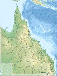
Wednesday Island , also called Mawain or Maururra , is a small uninhabited island in the Torres Strait Islands . It belongs to the Australian state of Queensland and is 3.2 km north of the much larger island of Moa . Closer are only the small Tuesday Islands , which are 2.5 km to the southeast. Wednesday Island is the northernmost island in the Thursday Islands .
From an administrative point of view, Wednesday Island is one of the Inner Islands , the southern island region of the Torres Shire administrative district .
The almost completely forested island is surrounded by a coral reef . It reaches its greatest height of 91 meters in the southern central area. An elevation of 84 meters is near Ince Point, the northern tip of the island. There is a lighthouse at Ince Point .
etymology
The western name of the island comes from Captain William Bligh , who drove the Torres Strait from June 2 (Tuesday) to June 5, 1789 (Friday) towards the west ( Kupang ). Some of the islands he passed, he named Tuesday Islands , Wednesday Island, Thursday Island and Friday Island after the days of the week of his four-day transit . Sunday Island, which he passed on the previous Sunday, May 31, 1789, is located around 200 kilometers southeast of the Torres Strait Islands near the east coast of the Cape York Peninsula .
Wednesday Island was inhabited earlier.


