
Talbot Islands
| Talbot Islands | ||
|---|---|---|
.png) |
||
| Waters | Pacific Ocean | |
| archipelago | Torres Strait Islands | |
| Geographical location | 9 ° 15 ′ S , 142 ° 13 ′ E | |
|
||
| Number of islands | 11 (3 main islands) | |
| Main island | Boigu | |
| Total land area | 107.26 km² | |
| Residents | 283 | |
 |
||

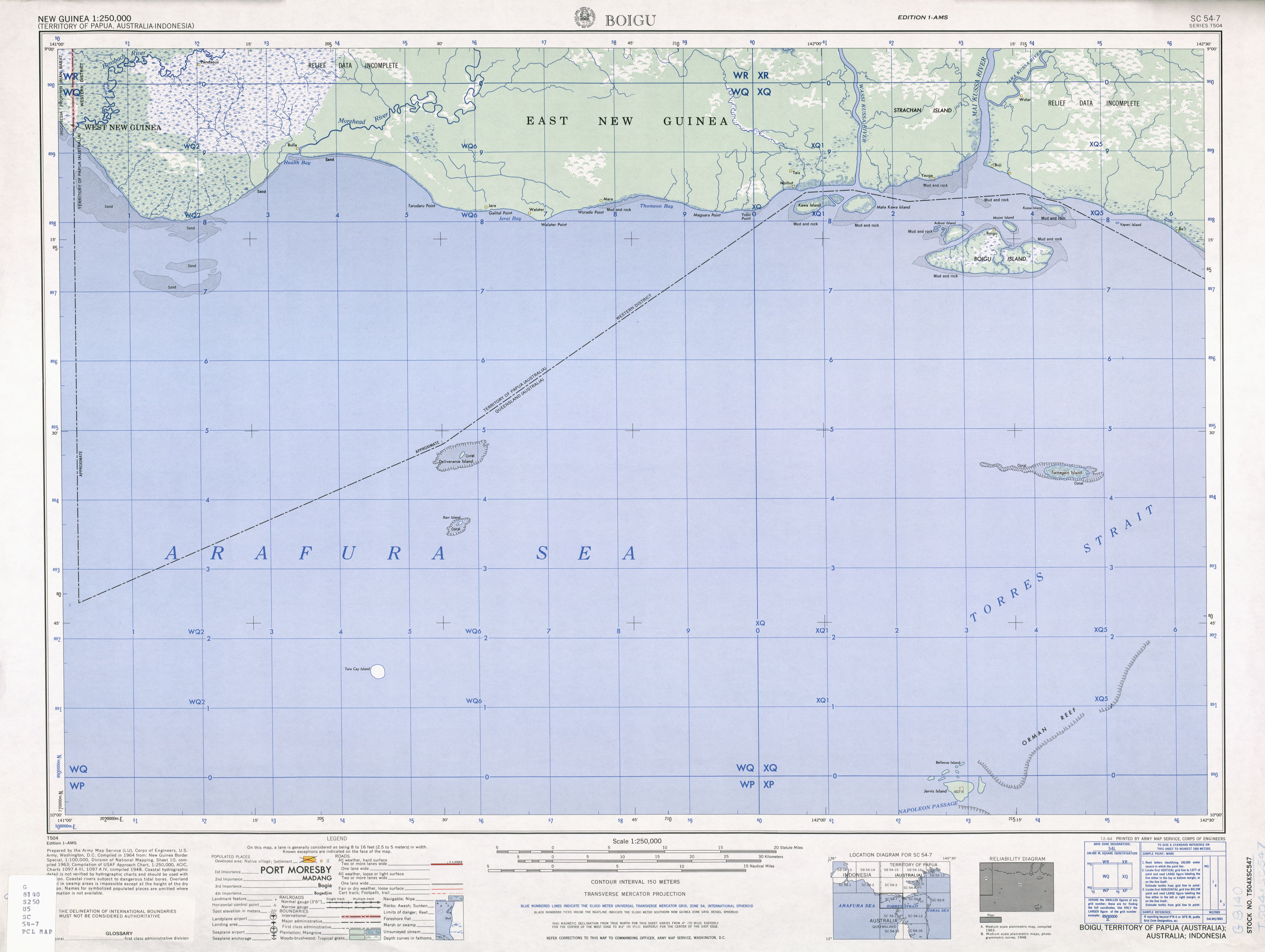
The Talbot Islands are a group of islands in the Torres Strait Islands archipelago . They are located a few kilometers off the south coast of Papua New Guinea at the mouth of the Mai Kussa River . Except for the islands located very close to the coast, they belong to the Australian state of Queensland .
The main island of Boigu had 283 inhabitants in 2006; all other islands in the group are uninhabited.
Table of the islands
![]() Map with all coordinates: OSM | WikiMap
Map with all coordinates: OSM | WikiMap
The Talbot Islands mainly include the following islands:
| Island name | Province (State) | Residents | Area km² |
Geographic coordinates |
|---|---|---|---|---|
| ( Athian Maza ) | Western Province (PNG) | uninhabited | - | 09 ° 13 ′ S , 142 ° 17 ′ E |
| Aubusi | Queensland (AUS) | uninhabited | 5.80 | 09 ° 14 ′ S , 142 ° 10 ′ E |
| Aymermud | Queensland (AUS) | uninhabited | 0.70 | 09 ° 14 ′ S , 142 ° 09 ′ E |
| Boigu | Queensland (AUS) | 283 | 72.32 | 09 ° 16 ' S , 142 ° 13' E |
| Kawai Islands | Western Province (PNG) | uninhabited | 20.66 | 09 ° 11 ′ S , 142 ° 00 ′ E |
| Kiss | Western Province (PNG) | uninhabited | 4.90 | 09 ° 12 ′ S , 142 ° 18 ′ E |
| Moegina Kawa | Queensland (AUS) | uninhabited | 0.38 | 09 ° 14 ′ S , 142 ° 09 ′ E |
| Moimi | Queensland (AUS) | uninhabited | 2.06 | 09 ° 14 ′ S , 142 ° 14 ′ E |
| Yaperi | Western Province (PNG) | uninhabited | 0.10 | 09 ° 13 ′ S , 142 ° 22 ′ E |
Note: in the table the unnamed islands west of Aubusi Iceland (at 9 ° 13 '50 " S , 142 ° 9' 4" O ) and Aymermud (at 9 ° 13 '50 " S , 142 ° 9' 4" O ) with a total area of around 27 ha are not included.
politics
Administratively, the Australian islands are one of the Top Western Islands , an island region in the Torres Shire administrative district of Queensland. The remaining islands belong to the western province of Papua New Guinea.
history
The Kawai Islands , around 10 km northwest of Boigu and a few hundred meters from the coast of New Guinea, still belong to the Talbot Islands. These islands, as well as Kussa Island northeast of the group, were given to Papua New Guinea in the Torres Strait Treaty of 1978. Until then, they appeared on maps as belonging to Australia.
See also
Individual evidence
- ↑ Sailing Directions (enroute) Pub. 164 (PDF; 4.1 MB): The Kawaii Islands, constituting the rest of the group, are close off to the entrance to the Wassi Kussa River
- ↑ http://www.austlii.edu.au/au/other/dfat/treaties/1985/4.html
- ↑ http://www.lib.utexas.edu/maps/ams/new_guinea/txu-oclc-6552576-sc54-7.jpg