Tetley Islands
| Tetley Islands | |
|---|---|
|
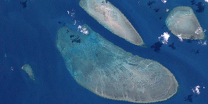
Landsat image of the South Ledge reef. The Tetley Islands can be seen in the lower center of the image as lighter dots. |
|
| Waters | Pacific Ocean |
| archipelago | Torres Strait Islands |
| Geographical location | 10 ° 44 ′ S , 142 ° 44 ′ E |
| Number of islands | 2 |
| Main island | Tetley Island |
| Total land area | 0.02 km² |
| Residents | uninhabited |
| Location of the Torres Strait Islands | |
The Tetley Islands ( English Tetley Islets ) are an Australian island group in the southeast of the archipelago of the Torres Strait Islands . They are located about 12.5 km east of York Island on the reef rim of the South Ledge reef, which is over 48 km² in size .
The uninhabited group consists of two very small islands:
| island | location | Area km² |
Geographic coordinates |
|---|---|---|---|
| Tetley Island | southeast | 0.012 | 10 ° 44 ′ S , 142 ° 44 ′ E |
| (unnamed) | Northwest | 0.010 | 10 ° 44 ′ S , 142 ° 44 ′ E |
Administratively, the Tetley Islands are part of the Central Islands , an island region in the Torres Shire administrative district of Queensland .

