Trochus Island
| Trochus Island | ||
|---|---|---|
|
Landsat image of Trochus Island (center, left) and Turtle Head Island (center). |
||
| Waters | Pacific Ocean ( Coral Sea ) | |
| Geographical location | 10 ° 55 '15 " S , 142 ° 37' 51" E | |
|
|
||
| length | 1.9 km | |
| width | 900 m | |
| surface | 1.6 km² | |
| Highest elevation | 18 m | |
| Residents | uninhabited | |
| Map of the Torres Strait Islands | ||
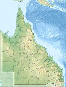
Trochus Island is an uninhabited Australian island in the extreme south of the Torres Strait Islands archipelago . It is located just a few hundred meters off the east coast of the Cape York Peninsula in Newcastle Bay at the mouth of the Middle River . Turtle Head Island is 1.3 km to the east .
Trochus Island is densely overgrown and fringed by a reef.
Administratively, the island is one of the Inner Islands , an island region in the Torres Shire administrative district of Queensland .
The island is the northernmost offshoot of the large Jardine River National Park .


