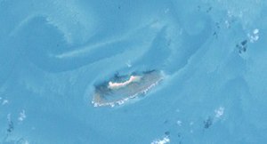
Turu Cay
| Turu Cay | ||
|---|---|---|
| Landsat image of the island | ||
| Waters | Arafura lake | |
| Archipelago | Torres Strait Islands | |
| Geographical location | 9 ° 49 '26 " S , 141 ° 25' 26" E | |
|
|
||
| length | 740 m | |
| width | 140 m | |
| surface | 8 ha | |
| Residents | uninhabited | |
Turu Cay is an eight- acre , elongated sand island in the northwest of the Torres Strait Islands . It is located 28 kilometers southwest of Kerr Island and 36 kilometers southwest of Deliverance Island , the two closest islands. Turu Cay is the westernmost of all the Torres Strait Islands.
Turu Cay belongs to the inhabitants of the islands of Saibai , Boigu and Dauan , and thus belongs to the island region of the Top Western Islands .
See also
Individual evidence
- ↑ Archived copy ( memento of the original from October 6, 2014 in the Internet Archive ) Info: The archive link was inserted automatically and has not yet been checked. Please check the original and archive link according to the instructions and then remove this notice.

