Turnagain Island
| Turnagain Island (Buru) |
||
|---|---|---|
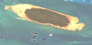
| Landsat image of Turnagain Island | ||
| Waters | Pacific Ocean | |
| Archipelago | Torres Strait Islands | |
| Geographical location | 9 ° 33 '54 " S , 142 ° 17' 23" E | |
|
|
||
| length | 7.5 km | |
| width | 2.2 km | |
| surface | 11.97 km² | |
| Residents | uninhabited | |
|
Torres Strait Islands location : Turnagain top, middle. |
||
Turnagain Island , also called Buru , is a small uninhabited island in the Torres Strait Islands . It is located about 38 km south of the coast of Papua New Guinea and over 125 km north of the Cape York Peninsula , but still belongs to the Australian state of Queensland . The closest islands are Dauan (29 km northeast) and Boigu (29 km northwest), both inhabited.
Administratively, Turnagain Island is one of the Top Western Islands , an island region in the Torres Shire administrative district .
The fully forested, elongated island is surrounded by a coral reef .


