
West Flanders Province
|
West Flanders West Vlaanderen ( Dutch ) Flandre-Occidentale ( French ) |
|
 |
 |
| Country: | Belgium |
| Region : | Flanders |
| Capital: | Bruges |
| Area : | 3,144 km² |
| Residents | 1,195,796 (Jan 1, 2019) |
| Population density | 380 inhabitants / km² |
| surface | 3,144 km² |
| Municipalities : | 64 |
| Website: | www.west-vlaanderen.be |
| NIS code | 30000 |
| politics | |
|---|---|
| Governor: |
Carl Decaluwe ( CD&V )
|
| Provincial Council: | Jean de Bethune ( CD&V ) |
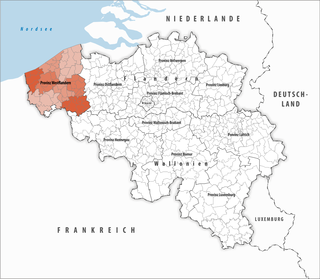
| Location of the province in Belgium | |
|
|
| 64 municipalities of the province | |
 |
|
West Flanders ( Dutch , West- Flemish West-Vloandern ) is a province of Belgium . It is located in the west of the Flanders region , which also includes the province of East Flanders .
The western and northern parts of the province mainly consist of flat polder areas . In the south there is a hill zone with the Kemmelberg (159 m) as the highest elevation. West Flanders and Antwerp are the only Belgian provinces that have direct access to the sea . The inhabitants speak one of the West Flemish dialects of Dutch.
The municipality of Comines-Warneton forms a Walloon exclave surrounded by West Flanders and France , which belongs to the province of Hainaut .
Governors
- 1944–1979: Baron Pierre van Outryve d'Ydewalle
- 1979: Leo Vanackere
- 1979–1997: Olivier Vanneste
- 1997–2012: Paul Breyne
- since 2012: Carl Decaluwe
Districts
The province of West Flanders is divided into eight districts. These are in French as arrondissements and in Dutch as arrondissementen referred. Sometimes the term arrondissement is also used in German, although district is the official term.
| district | Communities | Residents January 1, 2019 |
Area km² |
Density of population / km² |
NIS code |
|---|---|---|---|---|---|
| Bruges | 10 | 282.209 | 661.29 | 427 | 31000 |
| Diksmuide | 5 | 51,525 | 362.42 | 142 | 32000 |
| Kortrijk | 12 | 290,706 | 402.87 | 722 | 34000 |
| East End | 7th | 157,200 | 291.58 | 539 | 35000 |
| Roeselare | 8th | 153.315 | 271.54 | 565 | 36000 |
| Tielt | 9 | 92.905 | 329.79 | 282 | 37000 |
| Veurne | 5 | 61,657 | 275.21 | 224 | 38000 |
| Ypres | 8th | 106.279 | 549.62 | 193 | 33000 |
| West Flanders Province | 64 | 1,195,796 | 3,144.32 | 380 | 30000 |
Communities
See the infobox for the location of the municipality in the province.
- Alveringem
- Display
- Ardooie
- Avelgem
- Beernem
- Blankenberge
- Bredene
- Bruges
- Dams
- De Haan
- De Panne
- Deerlijk
- Dentergem
- Diksmuide
- Gistel
- Harelbeke
- Heuvelland
- Hooglede
- Houthulst
- Ichtegem
- Ieper (Ypres)
- Ingelmunster
- Izegem
- Jabbeke
- Knokke-Heist
- Koekelare
- Koksijde
- Cortemark
- Kortrijk
- Kuurne
- Langemark-Poel Chapel
- Ledegem
- Lichtervelde
- Lendelede
- Lo-Reninge
- Men
- Mesen
- Meulebeke
- Middelkerke
- Moorslede
- Nieuwpoort
- Ostend (Ostend)
- Oostkamp
- Oostrozebeke
- Oudenburg
- Pittem
- Poperinge
- Roeselare
- Ruiselede
- Spiere-Helkijn
- Staden
- Tielt
- Torhout
- Veurne
- Vleteren
- Commodity
- Wervik
- Wevelgem
- Wielsbeke
- Wingene
- Zedelgem
- Zonnebeke
- Zuienkerke
- Zwevegem
economy
In comparison with the gross domestic product of the European Union expressed in purchasing power standards , the province achieved an index of 115 (EU-25: 100) in 2015, slightly lower than the Belgian average of 119 but above the EU average.
In 2017, the unemployment rate was 3.2%, making it the lowest of any province in the country.
Web links
Individual evidence
- ↑ Eurostat. Retrieved April 27, 2018 .
- ↑ Unemployment rate, by NUTS 2 regions. Retrieved November 5, 2018 .
Provinces in Flanders:
Antwerp |
Flemish Brabant |
Limburg |
East Flanders |
West Flanders
Provinces in Wallonia:
Hainaut |
Liege |
Luxembourg |
Namur |
Walloon Brabant