Muzambinho: Difference between revisions
Content deleted Content added
No edit summary |
No edit summary |
||
| (11 intermediate revisions by 10 users not shown) | |||
| Line 6: | Line 6: | ||
|native_name = <!-- for cities whose native name is not in English --> |
|native_name = <!-- for cities whose native name is not in English --> |
||
|nickname = |
|nickname = |
||
|settlement_type =Municipality |
|settlement_type =Municipality |
||
|motto = |
|motto = |
||
<!-- images and maps -----------> |
<!-- images and maps -----------> |
||
| Line 18: | Line 18: | ||
|image_map = File:MinasGerais Municip Muzambinho.svg |
|image_map = File:MinasGerais Municip Muzambinho.svg |
||
|mapsize = |
|mapsize = |
||
|map_caption = |
|map_caption = Location in [[Minas Gerais]] |
||
|pushpin_map = Brazil |
|pushpin_map = Brazil |
||
|pushpin_map_caption = Location in [[Brazil]] |
|pushpin_map_caption = Location in [[Brazil]] |
||
|coordinates_display = inline,title |
|||
|coordinates_region = BR |
|||
|subdivision_type = Country |
|subdivision_type = Country |
||
|subdivision_name ={{flag|Brazil}} |
|subdivision_name ={{flag|Brazil}} |
||
| Line 40: | Line 38: | ||
|established_title = Founded |
|established_title = Founded |
||
|established_date = October 8th, 1860 |
|established_date = October 8th, 1860 |
||
|established_title1 = [[ |
|established_title1 = [[Municipal corporation#Brazil|Incorporated]] |
||
|established_date1 = November 12th, 1878 |
|established_date1 = November 12th, 1878 |
||
<!-- Area ---------------------> |
<!-- Area ---------------------> |
||
|area_magnitude = |
|area_magnitude = |
||
|unit_pref =Imperial <!--Enter: Imperial, if Imperial (metric) is desired--> |
|unit_pref =Imperial <!--Enter: Imperial, if Imperial (metric) is desired--> |
||
|area_footnotes = <ref name ="IBGE_Área">{{cite web |url=http://www.ibge.gov.br/home/geociencias/cartografia/default_territ_area.shtm |language=pt|title=Área territorial oficial|publisher=IBGE | |
|area_footnotes = <ref name ="IBGE_Área">{{cite web |url=http://www.ibge.gov.br/home/geociencias/cartografia/default_territ_area.shtm |language=pt|title=Área territorial oficial|publisher=IBGE |access-date=2015-03-30|date=2002-10-10|author=IBGE }}</ref> |
||
|area_total_km2 = 409036 |
|area_total_km2 = 409036 |
||
|area_land_km2 = <!--See table @ Template:Infobox Settlement for details on automatic unit conversion--> |
|area_land_km2 = <!--See table @ Template:Infobox Settlement for details on automatic unit conversion--> |
||
<!-- Population -----------------------> |
<!-- Population -----------------------> |
||
|population_as_of = |
|population_as_of = 2020 <ref>[https://cidades.ibge.gov.br/brasil/mg/muzambinho/panorama IBGE 2020]</ref> |
||
|population_footnotes = |
|||
|population_footnotes = <ref name="IBGE_Pop_2010">{{cite web |url = http://www.ibge.gov.br/home/estatistica/populacao/censo2010/populacao_por_municipio.shtm |title=Censo Populacional 2010|language=pt|publisher=Instituto Brasileiro de Geografia e Estatística (IBGE) |date=2010-11-29|accessdate = 2010-12-11}}</ref> |
|||
|population_note = |
|population_note = |
||
|population_total = |
|population_total = 20,545 |
||
|population_density_km2 = |
|population_density_km2 = |
||
<!-- General information ---------------> |
<!-- General information ---------------> |
||
|timezone = [[Time in Brazil|BRT]] |
|timezone = [[Time in Brazil|BRT]] |
||
|utc_offset = |
|utc_offset = −3 |
||
|timezone_DST = |
|timezone_DST = |
||
|utc_offset_DST = |
|utc_offset_DST = |
||
|coordinates = {{coord|21|22|33|S|46|31|33|W|region:BR|display=inline,title}} |
|||
|latd=21|latm= 22|lats= 33|latNS=S |
|||
|longd=46|longm=31|longs=33|longEW=W |
|||
|elevation_footnotes = <!--for references: use <ref> tags--> |
|elevation_footnotes = <!--for references: use <ref> tags--> |
||
|elevation_m = 1100 |
|elevation_m = 1100 |
||
|elevation_ft = <!-- accord. to Google Earth--> |
|elevation_ft = <!-- accord. to Google Earth--> |
||
<!-- Area/postal codes & others --------> |
<!-- Area/postal codes & others --------> |
||
|postal_code_type = [[ |
|postal_code_type = [[Código de Endereçamento Postal|CEP]] postal code |
||
|postal_code = 37890-000 |
|postal_code = 37890-000 |
||
|area_code_type = [[List of dialling codes in Brazil|Area code]] |
|||
|area_code = 35 |
|area_code = 35 |
||
|blank_name = '''[[Human Development Index|HDI]]''' (2008) <ref name="PNUD_IDH_2000">{{cite web |url=http://www.pnud.org.br/atlas/ranking/IDH-M%2091%2000%20Ranking%20decrescente%20(pelos%20dados%20de%202000).htm |language=pt|title=Ranking decrescente do IDH-M dos municípios do Brasil |date=2000 |publisher=Programa das Nações Unidas para o Desenvolvimento (PNUD) | |
|blank_name = '''[[Human Development Index|HDI]]''' (2008) <ref name="PNUD_IDH_2000">{{cite web |url=http://www.pnud.org.br/atlas/ranking/IDH-M%2091%2000%20Ranking%20decrescente%20(pelos%20dados%20de%202000).htm |language=pt |title=Ranking decrescente do IDH-M dos municípios do Brasil |date=2000 |publisher=Programa das Nações Unidas para o Desenvolvimento (PNUD) |access-date=2008-10-11 |archive-url=https://web.archive.org/web/20091003103229/http://www.pnud.org.br/atlas/ranking/IDH-M%2091%2000%20Ranking%20decrescente%20%28pelos%20dados%20de%202000%29.htm |archive-date=2009-10-03 |url-status=dead }}</ref> |
||
|blank_info = 0.801 |
|blank_info = 0.801 |
||
|website = [http://www.muzambinho.mg.gov.br/ Official Website] |
|website = [http://www.muzambinho.mg.gov.br/ Official Website] |
||
|footnotes = |
|footnotes = |
||
}} |
}} |
||
'''Muzambinho''' is a |
'''Muzambinho''' is a [[Municipalities of Brazil|municipality]] in the [[states of Brazil|state]] of [[Minas Gerais]] in the [[Southeast Region, Brazil|Southeast region]] of [[Brazil]].<ref name="PNUD_IDH_2000"/><ref name="IBGE_DTB_2008">{{cite web |url=https://geoftp.ibge.gov.br/organizacao_do_territorio/estrutura_territorial/divisao_territorial/2008/dtb_2008.zip |title=Divisão Territorial do Brasil |date=July 1, 2008 |publisher=Divisão Territorial do Brasil e Limites Territoriais, Instituto Brasileiro de Geografia e Estatística (IBGE) |access-date=December 17, 2009|language=pt}}</ref><ref name="IBGE_Pop_2009">{{cite web | url = http://www.ibge.gov.br/home/estatistica/populacao/estimativa2009/POP2009_DOU.pdf | title = Estimativas da população para 1º de julho de 2009| publisher = Estimativas de População, Instituto Brasileiro de Geografia e Estatística (IBGE) | date = August 14, 2009 | access-date=December 17, 2009 | format = [[PDF]]|language=pt }}</ref><ref name="IBGE_PIB_2005">{{cite web |url=http://www.ibge.gov.br/home/estatistica/economia/pibmunicipios/2005/tab01.pdf |title=Produto Interno Bruto dos Municípios 2002-2005 |date=December 19, 2007 |publisher=Instituto Brasileiro de Geografia e Estatística (IBGE) |access-date=December 17, 2009|language=pt}}</ref> |
||
==See also== |
==See also== |
||
| Line 81: | Line 80: | ||
{{reflist}} |
{{reflist}} |
||
{{Municipalities of Minas Gerais |
{{Municipalities of Minas Gerais|state=collapsed}} |
||
| ⚫ | |||
[[Category: |
[[Category:Municipalities in Minas Gerais]] |
||
| ⚫ | |||
Latest revision as of 11:10, 4 January 2022
Muzambinho | |
|---|---|
Municipality | |
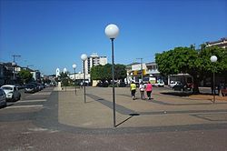
 View of Dr. Américo Luz avenue | |
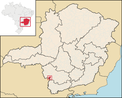
 Location in Minas Gerais | |
Location in Brazil | |
| Coordinates: 21°22′33″S 46°31′33″W / 21.37583°S 46.52583°W | |
| Country | |
| Region | Southeast |
| State | Minas Gerais |
| Mesoregion | South and Southwest of Minas Gerais |
| Microregion | São Sebastião do Paraíso |
| Founded | October 8th, 1860 |
| Incorporated | November 12th, 1878 |
| Government | |
| • Mayor | Ivan Antônio de Freitas |
| Area | |
| • Total | 157,930 sq mi (409,036 km2) |
| Elevation | 3,600 ft (1,100 m) |
| Population (2020 [2]) | |
| • Total | 20,545 |
| Time zone | UTC−3 (BRT) |
| CEP postal code | 37890-000 |
| Area code | 35 |
| HDI (2008) [3] | 0.801 |
| Website | Official Website |
Muzambinho is a municipality in the state of Minas Gerais in the Southeast region of Brazil.[3][4][5][6]
See also[edit]
References[edit]
- ^ IBGE (2002-10-10). "Área territorial oficial" (in Portuguese). IBGE. Retrieved 2015-03-30.
- ^ IBGE 2020
- ^ a b "Ranking decrescente do IDH-M dos municípios do Brasil" (in Portuguese). Programa das Nações Unidas para o Desenvolvimento (PNUD). 2000. Archived from the original on 2009-10-03. Retrieved 2008-10-11.
- ^ "Divisão Territorial do Brasil" (in Portuguese). Divisão Territorial do Brasil e Limites Territoriais, Instituto Brasileiro de Geografia e Estatística (IBGE). July 1, 2008. Retrieved December 17, 2009.
- ^ "Estimativas da população para 1º de julho de 2009" (PDF) (in Portuguese). Estimativas de População, Instituto Brasileiro de Geografia e Estatística (IBGE). August 14, 2009. Retrieved December 17, 2009.
- ^ "Produto Interno Bruto dos Municípios 2002-2005" (PDF) (in Portuguese). Instituto Brasileiro de Geografia e Estatística (IBGE). December 19, 2007. Retrieved December 17, 2009.


