
Adams County, Pennsylvania
![The Adams County Courthouse in Gettysburg, listed on the NRHP since 1974 [1]](https://de.wikipedia.org/wiki/Datei:Adams_PA_Courthouse_1.JPG) The Adams County Courthouse in Gettysburg, listed on the NRHP since 1974 |
|
| administration | |
|---|---|
| US state : | Pennsylvania |
| Administrative headquarters : | Gettysburg |
| Address of the administrative headquarters: |
Adams County Courthouse 111 Baltimore Street Gettysburg, PA 17325-2367 |
| Foundation : | January 22, 1800 |
| Made up from: | York County |
| Area code : | 001 717 |
| Demographics | |
| Residents : | 101,407 (2010) |
| Population density : | 75.3 inhabitants / km 2 |
| geography | |
| Total area : | 1351 km² |
| Water surface : | 4 km² |
| map | |
 |
|
| Website : www.adamscounty.us | |
The Adams County is a county in the US state of Pennsylvania . At the 2010 census , the county had 101,407 people and a population density of 75.3 people per square kilometer. The county seat is Gettysburg .
geography
The county is located in southern Pennsylvania and is separated from Maryland to the south by the Mason-Dixon Line . It has an area of 1,351 square kilometers, of which 4 square kilometers are water. The following neighboring counties border Adams County:
| Cumberland County | ||
| Franklin County |
.svg)
|
York County |
|
Frederick County, Maryland |
Carroll County, Maryland |
history

Adams County was formed on January 22, 1800 from former parts of York County . It was named after John Adams (1735–1826), the second President of the United States (1797–1801).
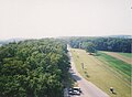
In Adams County, the Battle of Gettysburg took place in July 1863 , one of the bloodiest battles and one of the turning points of the American Civil War , in which over 34,000 soldiers died.
Historical objects

Gettysburg Battlefield Historic District , listed on the NRHP since 1975
Gettysburg National Military Park , listed on the NRHP since 1966
Gettysburg Armory , listed on the NRHP since 1990
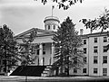
Pennsylvania Hall in Gettysburg, listed on the NRHP since 1972
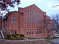
Lutheran Seminary in Gettysburg, listed in the NRHP since 1974

Sauck's Covered Bridge near Gettysburg, listed in the NRHP since 1980

Log house in the East Berlin Historic District , listed in the NRHP since 1985

Abbott House in Abbottstown, listed on the NRHP since 1980


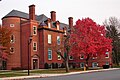
The county has two protected sites of major importance to American history, the Eisenhower National Historic Site and the Gettysburg National Military Park . 33 buildings and sites in the county are listed on the National Register of Historic Places (NRHP) (as of July 18, 2018).
Demographic data
| Population development | |||
|---|---|---|---|
| Census | Residents | ± in% | |
| 1800 | 13,172 | - | |
| 1810 | 15,152 | 15% | |
| 1820 | 19,370 | 27.8% | |
| 1830 | 21,379 | 10.4% | |
| 1840 | 23,044 | 7.8% | |
| 1850 | 25,981 | 12.7% | |
| 1860 | 28.006 | 7.8% | |
| 1870 | 30,315 | 8.2% | |
| 1880 | 32,455 | 7.1% | |
| 1890 | 33,486 | 3.2% | |
| 1900 | 34,496 | 3% | |
| 1910 | 34,319 | -0.5% | |
| 1920 | 34,583 | 0.8% | |
| 1930 | 37,128 | 7.4% | |
| 1940 | 39,435 | 6.2% | |
| 1950 | 44.197 | 12.1% | |
| 1960 | 51.906 | 17.4% | |
| 1970 | 56,937 | 9.7% | |
| 1980 | 68.292 | 19.9% | |
| 1990 | 78.274 | 14.6% | |
| 2000 | 91,292 | 16.6% | |
| 2010 | 101.407 | -99.9% | |
| before 1900 1900–1990 2000 2010 | |||
As of the 2010 census , Adams County had 101,407 people in 37,704 households. The population density was 75.3 inhabitants per square kilometer.
The racial the population was composed of 93.7 percent white, 1.5 percent African American, 0.2 percent Native American, 0.7 percent Asian and other ethnic groups; 1.3 percent were descended from two or more races. Hispanic or Latino of any race was 6.0 percent of the population.
Statistically, 2.57 people lived in each of the 37,704 households.
22.1 percent of the population were under 18 years old, 62.2 percent were between 18 and 64 and 15.7 percent were 65 years or older. 50.8 percent of the population was female.
The median income for a household was 55,888 USD . The per capita income was $ 24,783. 7.2 percent of the population lived below the poverty line.
Places in Adams County

Adams County is divided into 34 parishes, including 13 boroughs and 21 townships . For statistical purposes, the US Census Bureau maintains 14 census-designated places . These are part of a township and have no self-administration.
Census-designated places (CDP)
other unincorporated communities
Individual evidence
- ↑ Extract from the National Register of Historic Places - No. 74001728. Retrieved December 19, 2011
- ↑ Adams County in the Geographic Names Information System of the United States Geological Survey Accessed 22 February 2011
- ^ National Association of Counties.Retrieved December 19, 2011
- ↑ Charles Curry Aiken, Joseph Nathan Kane: The American Counties: Origins of County Names, Dates of Creation, Area, and Population Data, 1950-2010 . 6th edition. Scarecrow Press, Lanham 2013, ISBN 978-0-8108-8762-6 , p. 3 .
- ↑ Extract from the National Register of Historic Places - No. 75000155.Retrieved December 19, 2011
- ↑ Extract from the National Register of Historic Places - No. 66000642.Retrieved December 19, 2011
- ↑ Extract from the National Register of Historic Places - No. 90000422.Retrieved December 19, 2011
- ↑ Extract from the National Register of Historic Places - No. 72001087. Retrieved December 19, 2011
- ↑ Extract from the National Register of Historic Places - No. 74001729.Retrieved December 19, 2011
- ↑ Extract from the National Register of Historic Places - No. 80003395.Retrieved December 19, 2011
- ↑ Extract from the National Register of Historic Places - No. 85002693.Retrieved December 19, 2011
- ↑ Extract from the National Register of Historic Places - No. 80003394.Retrieved December 19, 2011
- ↑ Listing of National Historic Landmarks by State: Pennsylvania . National Park Service , accessed July 18, 2018.
- ↑ Search mask database in the National Register Information System. National Park Service , accessed July 18, 2018.
- ^ University of Virginia Library. Retrieved December 19, 2011
- ^ Extract from Census.gov.Retrieved February 28, 2011
- ↑ Excerpt from factfinder.census.gov.Retrieved February 28, 2011
- ↑ a b U.S. Census Bureau, State & County QuickFacts - York County Retrieved December 19, 2011
Web links
- Official website
- US Census Bureau, State & County QuickFacts - Adams County
- Yahoo Image Search - Adams County
- www.city-data.com - Adams County
List of counties in Pennsylvania
Adams |
Allegheny |
Armstrong |
Beaver |
Bedford |
Berks |
Blair |
Bradford |
Bucks |
Butler |
Cambria |
Cameron |
Carbon |
Center |
Chester |
Clarion |
Clearfield |
Clinton |
Columbia |
Crawford |
Cumberland |
Dauphin |
Delaware |
Elk |
Erie |
Fayette |
Forest |
Franklin |
Fulton |
Greene |
Huntingdon |
Indiana |
Jefferson |
Juniata |
Lackawanna |
Lancaster |
Lawrence |
Lebanon |
Lehigh |
Alfalfa |
Lycoming |
McKean |
Mercer |
Mifflin |
Monroe |
Montgomery |
Montour |
Northampton |
Northumberland |
Perry |
Philadelphia |
Pike |
Potter |
Schuylkill |
Snyder |
Somerset |
Sullivan |
Susquehanna |
Tioga |
Union |
Venango |
Warren |
Washington |
Wayne |
Westmoreland |
Wyoming |
York
Coordinates: 39 ° 52 ′ N , 77 ° 13 ′ W