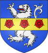
Arvier
| Arvier | ||
|---|---|---|

|
|
|
| Country | Italy | |
| region | Aosta Valley | |
| Coordinates | 45 ° 42 ′ N , 7 ° 10 ′ E | |
| height | 776 m slm | |
| surface | 33 km² | |
| Residents | 861 (Dec. 31, 2019) | |
| Population density | 26 inhabitants / km² | |
| Post Code | 11011 | |
| prefix | 0165 | |
| ISTAT number | 007005 | |
| Popular name | Arvelains | |
| Patron saint | Saint Sulpice | |
| Website | Arvier | |
Arvier is an Italian commune in the autonomous region of Aosta Valley . The community has 861 inhabitants (as of December 31, 2019), lies on the orographic right side of the Dora Baltea at an average altitude of 776 m slm and has a size of 33 km². The inhabitants are called Arvelains .
Arvier consists of the districts Baise-Pierre, Chamençon, Chamin, Chez Les Fournier, Chez les Garin, Chez Les Moget, Chez Les Roset, Grand-Haury, La Crête, La Ravoire, Leverogne, Mecosse, Petit-Haury, Planaval, Rochefort , Verney. The neighboring municipalities are Avise , Introd , La Thuile , Rhêmes-Saint-Georges , Saint-Nicolas , Valgrisenche and Villeneuve .
Arvier is an important wine-growing place in the valley. Here the Enfer d'Arvier , a red wine with the status of a Denominazione di origine controllata, is produced.
The parish church was mentioned in papal documents from the 13th century.
During the time of fascism , the village had the Italianized name Arviè .
Attractions
Individual evidence
- ↑ Statistiche demografiche ISTAT. Monthly population statistics of the Istituto Nazionale di Statistica , as of December 31 of 2019.


