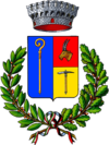
Cogne
| Cogne | ||
|---|---|---|

|
|
|
| Country | Italy | |
| region | Aosta Valley | |
| Coordinates | 45 ° 36 ′ N , 7 ° 22 ′ E | |
| height | 1534 m slm | |
| surface | 212 km² | |
| Residents | 1,350 (Dec. 31, 2019) | |
| Population density | 6 inhabitants / km² | |
| Factions | Veulla (chef-lieu), Boutillères, Champlong, Crétaz, Épinel, Gimillan, Moline, Montroz, Lillaz , Valnontey. | |
| Post Code | 11012 | |
| prefix | 0165 | |
| ISTAT number | 007021 | |
| Popular name | Cognini (Italian) Cogneins (French) |
|
| Patron saint | Ursus of Aosta | |
| Website | Cogne | |
Cogne is an Italian commune with 1,350 inhabitants (as of December 31, 2019) in the Cogne Valley, a side valley of the Aosta Valley region . The community lies at an altitude of 1534 m slm and has an area of 212 km².
Cogne is one of the tourist resorts in the Alps that have come together in the Alpine Pearls program .
language
The traditional language in the Cogne Valley is a Valdostan dialect of Franco-Provençal . French was the official language since the 16th century and Italian since the late 19th century.
The place name comes from the dialect expression cougn, which means "place" in German, which refers to the main settlement in the valley.
geography
With a municipal area of 213 square kilometers, Cogne is the largest municipality in the Aosta Valley in terms of area. There are five side valleys in the mountains: Valnontey, Vallon de Grauson, Urtier Valley , Valleille and Gimillantal.
The settlement landscape consists of the districts (French hameaux ) Veulla (main town), Boutillères, Champlong, Crétaz, Épinel, Gimillan, Moline, Montroz, Lillaz and Valnontey.
The Grant Eyvia torrent is the main river in the valley and a right tributary of the Dora Baltea . The Cogne valley has an extensive mountain basin in the Gran Paradiso massif, which is separated from the main valley of the Dora Baltea by a long gorge. In the valley lies the small town of Cogne, which gained importance through ore mining . The last iron ore mining is Alpinart documented, a mine museum in a former mining village .
The left, south-western side of the valley is in the area of the Gran Paradiso National Park .
The neighboring municipalities of Cogne are Aymavilles , Brissogne , Champorcher , Charvensod , Fénis , Gressan , Locana ( TO ), Noasca (TO), Ronco Canavese (TO), Saint-Marcel , Valprato Soana (TO) and Valsavarenche .
tourism
Cogne is the starting point for hikes in the Gran Paradiso area and on the Haute route no.2 . Cogne is part of the Gran Paradiso National Park. The Rifugio Vittorio Sella refuge can be reached from the Valnontey district and the Sogno di Berdzé al Péradzà refuge from Lillaz .
There is a small ski area near Cogne, which is accessible with a ski bus, a cable car at Laydatré and two chair lifts.
The community has been a member of the Alpine Pearls tourist network since 2011 , which promotes environmentally friendly tourism.
traffic
From the Dora Baltea valley, a mountain road leads from Aymavilles through the Grant Eyvia Gorge to Cogne.
The Cogne-Eaux-Froides mining railway was in operation from 1923 to 1979 .
Personalities
- Vincenzo Perruchon, skier
- Joëlle Cunéaz, skier and journalist
- César-Emmanuel Grappein, doctor and politician
- Léon-Clément Gérard (1810–1876), clergyman and writer
- Anselme Perret (1866–1907), writer
- Reine Bibois (1894–1976), dialect poet
- Ranjar Nordensten, mine director
Individual evidence
- ↑ Statistiche demografiche ISTAT. Monthly population statistics of the Istituto Nazionale di Statistica , as of December 31 of 2019.
- ↑ French official pronunciation / kɔɲ /, Italian pronunciation / ˈkɔɲɲe /: see the entry Cogne des Dizionario d'ortografia e di pronunzia .
- ↑ Alpinart
- ↑ https://www.alpine-pearls.com/die-urlaubsorte/ort/italien/cogne/


