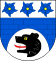
Bartošovice v Orlických horách
| Bartošovice v Orlických horách | ||||
|---|---|---|---|---|
|
||||
| Basic data | ||||
| State : |
|
|||
| Region : | Královéhradecký kraj | |||
| District : | Rychnov nad Kněžnou | |||
| Area : | 3561 ha | |||
| Geographic location : | 50 ° 12 ' N , 16 ° 32' E | |||
| Height: | 579 m nm | |||
| Residents : | 199 (Jan. 1, 2019) | |||
| Postal code : | 517 61 | |||
| structure | ||||
| Status: | local community | |||
| Districts: | 1 | |||
| administration | ||||
| Mayor : | Kostas Kotanidis (as of 2007) | |||
| Address: | Bartošovice v Orlických horách 35 517 61 Rokytnice v Orl. horách |
|||
| Municipality number: | 576093 | |||
| Website : | www.bartosovice.eu | |||
Bartošovice v Orlických horách (German Batzdorf ) is a municipality in the Okres Rychnov nad Kněžnou in Eastern Bohemia. It is located in the extreme southeast of the Eagle Mountains and can be reached via the state road 311, which starts at Žamberk and continues from Bartošovice in a north-westerly direction along the right bank of the Wild Eagles .
geography
Bartošovice is located on both sides of the Aubach ( Bartošovický potok ) in a side valley of the Wild Eagles on the border with Poland. Neighboring towns are Vrchní Orlice ( Hohen Erlitz ) in the north, České Petrovice ( Böhmisch Petersdorf ) in the southeast, Klášterec nad Orlicí in the south, Bubnov ( Bubenetz ) and Zaječiny ( Hasendorf ) in the southwest, Rokytnice v Orlických horách in the west and Panské Pole ( Herrnfeld ) , Hanička ( Hännchen ) and Udoličko ( Liebenthal ) in the north-west. Beyond the border, on the left bank, lie the Wild Eagles Niemojów ( Marienthal ) in the north and Lesica ( Freiwalde ) in the southwest.
history
Batzdorf was established between 1539 and 1557 as the first settlement in the Erlitztal and was populated with timber miners and raftsmen. In 1557 it was first mentioned in a document as a free judge property . It belonged to the Königgrätzer Kreis in Bohemia . The 1673 built and St. Church dedicated to Maria Magdalena was elevated to parish church in 1746.
In 1850 Batzdorf became an independent municipality and belonged to the Senftenberg district administration . The elementary school, built in 1892, was initially divided into three classes. After the founding of Czechoslovakia in 1918, the school was continued in two classes and a Czech minority school was set up. In 1930 there were 301 residents in the community.
As a result of the Munich Agreement , Batzdorf was annexed to the German Reich in 1938 and belonged to the Grulich district until 1945 . In 1939, 845 people lived in 216 houses in the village. After the Second World War, the German residents were expelled .
Economic development
The place developed into a location with many craftsmen and industrial companies. Winter sports equipment was manufactured and delivered all over the world. The main agricultural crops were flax , oats , barley and rye , as well as cabbage and potatoes . In animal feed were initially turnips , later beets grown.
Attractions
- The Maria Magdalena Church, built in 1673, was destroyed by lightning in 1793 and rebuilt. After further destruction by lightning in 1906, it was rebuilt by the patron saint Oskar Parish Freiherr von Senftenberg (1864–1925), but was given a pyramid-shaped tower instead of the onion-shaped tower.
- In the local area of Neratov there is a baroque Marian pilgrimage church.
Community structure
The municipality of Bartošovice includes the locations Neratov ( Bärnwald ), Malá Strana ( half- sides ), Vrchní Orlice ( Hohenerlitz ), Nová Ves ( Neudorf ) and Podlesí ( Schönwald ).
Demographic data
| number | 1836 | 1869 | 1890 | 1910 | 1930 | 1939 | 1950 | 1961 | 1970 | 2001 | 2003 | 2004 | 2006 | 2010 |
|---|---|---|---|---|---|---|---|---|---|---|---|---|---|---|
| Residents | 1228 | 1361 | 1270 | 1059 | 873 | 845 | 210 | 285 | 256 | 218 | 213 | 205 | 195 | 217 |
| Houses | 263 | 265 | 252 | 232 | 216 | 151 | 63 | 74 |
Personalities
- Karl Franz Pitsch (1786–1858) organist and composer
Web links
- Bartošovice commune
- Site about the municipality of Bartošovice
- German-language website about Batzdorf
- Location descriptions Adlergebirge down

