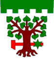
Bohdašín
| Bohdašín | ||||
|---|---|---|---|---|
|
||||
| Basic data | ||||
| State : |
|
|||
| Region : | Královéhradecký kraj | |||
| District : | Rychnov nad Kněžnou | |||
| Area : | 538 ha | |||
| Geographic location : | 50 ° 21 ' N , 16 ° 13' E | |||
| Height: | 485 m nm | |||
| Residents : | 214 (Jan. 1, 2019) | |||
| Postal code : | 518 01 | |||
| traffic | ||||
| Street: | Dobruška - Nový Hrádek | |||
| structure | ||||
| Status: | local community | |||
| Districts: | 2 | |||
| administration | ||||
| Mayor : | Jaromír Štěpán (status: 2014) | |||
| Address: | Bohdašín 21 518 01 Dobruška |
|||
| Municipality number: | 576115 | |||
| Website : | www.bohdasin.cz | |||
Bohdašín (German Bochdaschin ) is a municipality in the Czech Republic . It is located six kilometers east of Nové Město nad Metují and belongs to the Okres Rychnov nad Kněžnou .
geography
Bohdašín is located to the left of the Olešenka River in the northwestern foothills of the Eagle Mountains . The Bohdašínský potok rises in the village . To the north of the village, on the opposite side of the Olešenka valley, the remains of the Frymburk castle lie on a rock spur . In the northeast is the Marian pilgrimage site Rokole .
Neighboring towns are Mezilesí , Bydlo and Doly in the north, Nový Hrádek and Rokole in the northeast, Tis in the east, Janov and Bystré in the southeast, Ohnišov in the south, Vanovka in the southwest and Slavoňov in the northwest.
history
The village of Bohdašín, which belongs to the Frymburk lordship, was first mentioned in a document in 1534 when it was sold by Achilles Anděl von Ronov to Jan Trčka von Lípa . The name of the place is said to be derived from a miner's greeting Boh da šín , which expresses the hope of a rich ore find . Iron ore had been mined in the Olešenka valley since 1446 and an iron hammer was in operation. Under the Trčka of Lípa, the Frymburk dominion was attached to Opočno in the 16th century .
After Hieronymus von Colloredo -Wallsee had the parish in Nový Hrádek set up as a subsidiary of Slavoňov in 1721, the village, which had previously belonged to Slavoňov, was re-parished there. In 1786 the church in Nový Hrádek was elevated to a parish church and assigned to Slavoňov as a branch. In 1822 a bell tower was built in Bohdašín. In 1829 home weaving was started as a sideline.
After the abolition of patrimonial Bohdašín became an independent municipality in 1848. At that time the village consisted of 61 houses and had 419 inhabitants. The district of Vanovka belonged to the district, in whose eleven houses 60 people lived. In 1930 the community had 442 inhabitants, of whom 335 lived in Bohdašín, 59 in Bydlo and 49 in Vanovka. In 1937 Bohdašín was electrified.
After the assassination attempt on Reinhard Heydrich and the extermination of Ležáky , Bohdašín was surrounded by the Wehrmacht and searched, as a partisan base and a radio transmitter were suspected in the village, but they were in the other Bohdašín .
Community structure
The municipality Bohdašín consists of the districts Bohdašín ( Bochdaschin ) and Vanovka ( Wannow ) and the localities Bydlo ( home ) and Rokole.
Attractions
- chapel
- Marian pilgrimage church Rokole, southeast of the village on the Olešenka. The little church, consecrated in 1930, replaced a wooden chapel from 1859. The Betlém Apostle Chapel of the Schoenstatt Movement is still located at the pilgrimage site . The stone Way of the Cross from the Olešenka Valley was laid out in 1874.

