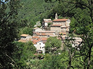
Chambon (Gard)
| Chambon | ||
|---|---|---|
|
|
||
| region | Occitania | |
| Department | Gard | |
| Arrondissement | Alès | |
| Canton | La Grand-Combe | |
| Community association | Alès agglomeration | |
| Coordinates | 44 ° 18 ′ N , 4 ° 7 ′ E | |
| height | 207-644 m | |
| surface | 14.65 km 2 | |
| Residents | 266 (January 1, 2017) | |
| Population density | 18 inhabitants / km 2 | |
| Post Code | 30450 | |
| INSEE code | 30079 | |
 Notre-Dame church |
||
Chambon is a French commune with 266 inhabitants (as of January 1, 2017) in the Gard department in the Occitanie region . It belongs to the canton of La Grand-Combe and the Arrondissement of Alès .
geography
The village of Chambon is located in the valley of the Luech .
Neighboring municipalities are Sénéchas in the northwest, Génolhac in the north, Malbosc in the northeast, Peyremale in the east, Portes in the southeast, La Vernarède and Chamborigaud in the southwest and Génolhac in the west.
Population development
| year | 1962 | 1968 | 1975 | 1982 | 1990 | 1999 | 2006 | 2017 |
| Residents | 418 | 273 | 222 | 183 | 196 | 240 | 271 | 266 |
| Sources: Cassini and INSEE | ||||||||

The viaduct of the Cevennes Railway between Chambon and Chamborigaud, a monument historique since 1984
Web links
Commons : Chambon - Collection of Images

