Saint-Victor-de-Malcap
| Saint-Victor-de-Malcap | ||
|---|---|---|

|
|
|
| region | Occitania | |
| Department | Gard | |
| Arrondissement | Alès | |
| Canton | Rousson | |
| Community association | Cèze-Cévennes | |
| Coordinates | 44 ° 15 ′ N , 4 ° 13 ′ E | |
| height | 117-231 m | |
| surface | 10.87 km 2 | |
| Residents | 833 (January 1, 2017) | |
| Population density | 77 inhabitants / km 2 | |
| Post Code | 30500 | |
| INSEE code | 30303 | |
| Website | http://www.saintvictordemalcap.com/ | |
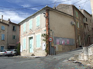
 Town hall (Mairie) of Saint-Victor-de-Malcap |
||
Saint-Victor-de-Malcap is a French commune with 833 inhabitants (as of January 1, 2017) in the Gard department of the Occitanie region (before 2016 Languedoc-Roussillon ). Meyrannes belongs to the arrondissement of Alès and the canton of Rousson (until 2015 Saint-Ambroix ).
geography
Saint-Victor-de-Malcap is located about 20 kilometers northeast of Alès on the Cèze , which borders the municipality in the south and west, in the Cevennes . Saint-Victor-de-Malcap is surrounded by the neighboring communities of Saint-Brès in the north and north-west, Saint-Sauveur-de-Cruzières in the north and north-east, Saint-Jean-de-Maruéjols-et-Avéjan in the east, Rochegude in the east and South-east, Saint-Denis in the south-east, Potelières in the south and Saint-Ambroix in the west and south-west.
Population development
| year | 1962 | 1968 | 1975 | 1982 | 1990 | 1999 | 2006 | 2013 |
| Residents | 485 | 412 | 412 | 505 | 506 | 538 | 629 | 829 |
| Source: Cassini and INSEE | ||||||||
Attractions
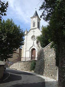
- church
- lock

